Jeep and 4x4 trails
Know which trails are legal, even with no signal
On national forest and BLM land you may only drive the routes that are open to your vehicle, and the official maps that say which ones are open are free. Cartahaven puts those maps on your phone and shows your GPS position on them with no cell signal, so you can tell which numbered road you are on before you turn onto it.
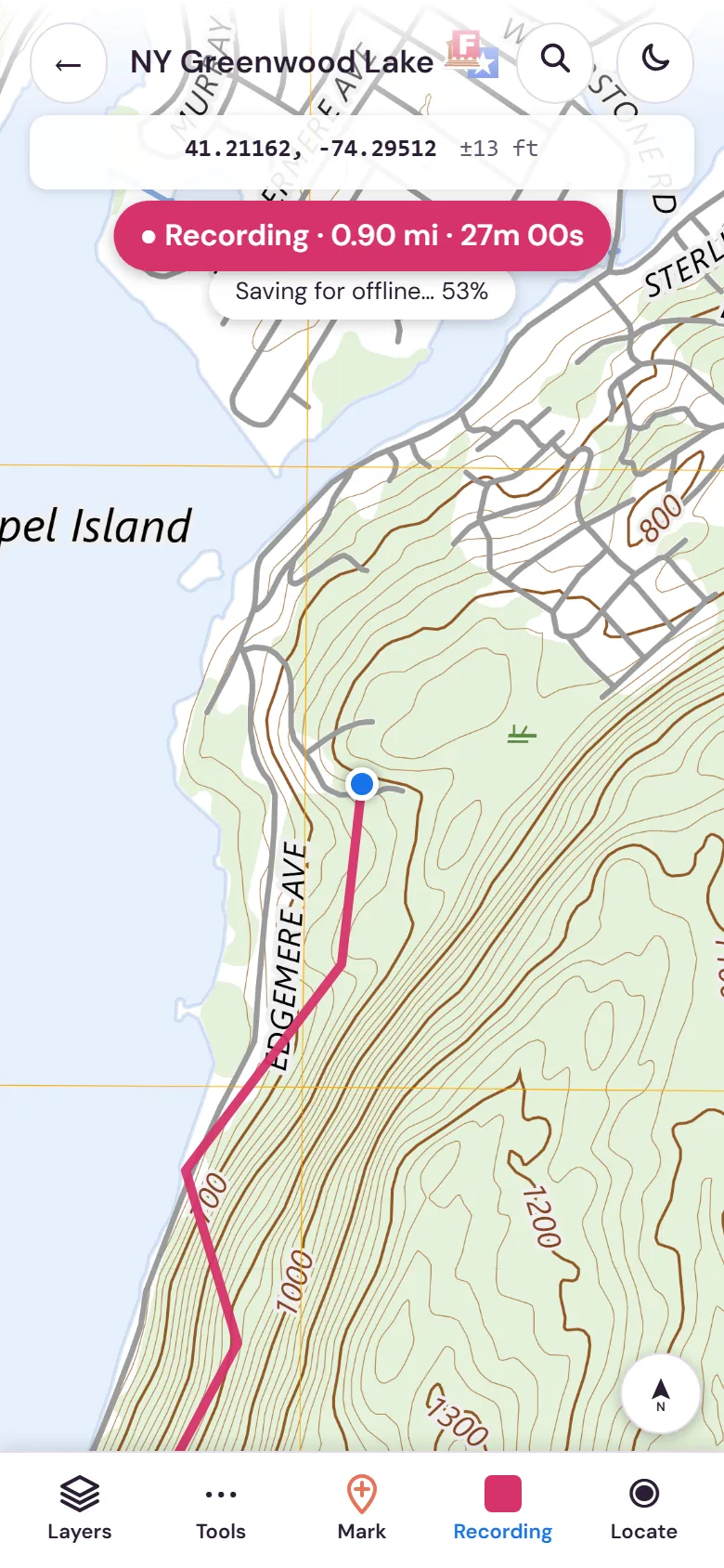
Which routes your Jeep may drive
On a national forest or grassland, the Motor Vehicle Use Map (MVUM) is the official list of roads and trails open to motor vehicles, which kinds, and when. A route that isn’t shown as open to your vehicle is closed to it. For a street-legal Jeep or truck, look for roads open to all vehicles or to highway-legal vehicles, within the dates printed on the map. Trails marked for vehicles 50 inches wide or less are for ATVs, not a Jeep.
On BLM land, areas are open, limited or closed to motor vehicles; in limited areas you stay on designated routes. BLM travel management and recreation maps show them. How to read an MVUM and BLM land maps walk through the symbols and designations.
The maps worth downloading
- Forest Service MVUMs for every ranger district on your route, front and back. They are free in the Forest Service maps, kept current when a forest posts a new edition.
- Forest visitor maps for the bigger picture: campgrounds, trailheads and the road network around the MVUM routes.
- BLM recreation and travel-management maps where your trip crosses BLM land, in the BLM maps.
- Off-road and trail maps from publishers and clubs, under off-roading.
Every map keeps a US public land layer around it, so you can see Forest Service and BLM land past the edge of the sheet.
Get them on your phone before you lose signal
- Find each map and tap “Get this map”. The Forest Service maps are free; you need a free account to keep them.
- Open the map app on your phone (app.cartahaven.com; install it to the home screen), sign in with the same account and tap “Get my maps”.
- Open every map once with airplane mode on, at home, so you know it works.
- On the trail, the blue dot sits on the map’s own lines and route numbers. GPS works from satellites, so it keeps working where there are no bars.
Already have a GeoPDF from a forest or BLM office? Tap “Import” in the app and pick the file; it works the same way.
On the trail
- Record a track of the route you drive, and drop placemarks for camps, gates, water and the spot where the trail got too rough.
- Check conditions before you go. In the app, Layers, Conditions: “Fire restrictions” links to the alerts page of each national forest on your map, and “Wildfires” shows current fires.
- Mount the phone where the driver can glance at it, and carry a charging cable. A printed copy is a sensible backup on long trips.
What the maps don’t tell you
- Whether a road is open today. Temporary closures for fire, flood or construction are separate orders; check the forest or BLM office’s alerts before you go.
- Whether a road is passable. Open to your vehicle doesn’t mean graded or easy. Know your Jeep, your tires and your recovery gear.
- State rules. Some states require an OHV sticker or trail permit on designated OHV trails, even for street-legal vehicles; state land has its own rules.