Wyoming historical topo maps
Cartahaven has 115 historical topo maps of Wyoming, all free. These are the USGS 15-minute (1:62,500) quadrangles from the mid-1900s: old roads, mines, homesteads, rail lines and place names that newer maps leave off.
Download one to your phone and the map app shows your GPS position on it with no cell signal.

Baggs, WY
Old map for history, not navigation
USGS historical 15-minute topo (1957)

Barnum, WY
Old map for history, not navigation
USGS historical 15-minute topo (1961)
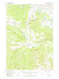
Beartooth Butte, WY
Old map for history, not navigation
USGS historical 15-minute topo (1956)

Betty Reservoir, WY
Old map for history, not navigation
USGS historical 15-minute topo (1959)

Beulah, WY
Old map for history, not navigation
USGS historical 15-minute topo (1958)

Bill, WY
Old map for history, not navigation
USGS historical 15-minute topo (1959)

Blue Mesa, WY
Old map for history, not navigation
USGS historical 15-minute topo (1914)

Blue Mesa, WY
Old map for history, not navigation
USGS historical 15-minute topo (1916)

Boars Tusk, WY
Old map for history, not navigation
USGS historical 15-minute topo (1958)

Bolten Ranch, WY
Old map for history, not navigation
USGS historical 15-minute topo (1956)

Bridger Pass, WY
Old map for history, not navigation
USGS historical 15-minute topo (1956)

Buckboard Crossing, WY
Old map for history, not navigation
USGS historical 15-minute topo (1966)

Canyon Village, WY
Old map for history, not navigation
USGS historical 15-minute topo (1959)

Cedar Ridge, WY
Old map for history, not navigation
USGS historical 15-minute topo (1957)

Cheyenne, WY
Old map for history, not navigation
USGS historical 15-minute topo (1950)

Cheyenne, WY
Old map for history, not navigation
USGS historical 15-minute topo (1961)

Clark, WY
Old map for history, not navigation
USGS historical 15-minute topo (1950)

Coal Draw, WY
Old map for history, not navigation
USGS historical 15-minute topo (1959)

Cody, WY
Old map for history, not navigation
USGS historical 15-minute topo (1949)

Cody, WY
Old map for history, not navigation
USGS historical 15-minute topo (1951)

Colony, WY
Old map for history, not navigation
USGS historical 15-minute topo (1957)

Como Ridge, WY
Old map for history, not navigation
USGS historical 15-minute topo (1915)

Como Ridge, WY
Old map for history, not navigation
USGS historical 15-minute topo (1918)

Currant Creek Ranch, WY
Old map for history, not navigation
USGS historical 15-minute topo (1957)

Currant Creek Ranch, WY
Old map for history, not navigation
USGS historical 15-minute topo (1966)

Dead Indian Peak, WY
Old map for history, not navigation
USGS historical 15-minute topo (1956)

Deep Lake, WY
Old map for history, not navigation
USGS historical 15-minute topo (1950)

Devils Tooth, WY
Old map for history, not navigation
USGS historical 15-minute topo (1957)
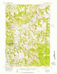
Devils Tower, WY
Old map for history, not navigation
USGS historical 15-minute topo (1955)

Doty Mountain, WY
Old map for history, not navigation
USGS historical 15-minute topo (1957)

Eagle Peak, WY
Old map for history, not navigation
USGS historical 15-minute topo (1959)

Edgerton, WY
Old map for history, not navigation
USGS historical 15-minute topo (1959)

Essex Mountain, WY
Old map for history, not navigation
USGS historical 15-minute topo (1958)

Esterbrook, WY
Old map for history, not navigation
USGS historical 15-minute topo (1943)

Esterbrook, WY
Old map for history, not navigation
USGS historical 15-minute topo (1945)

Fifty-Five Ranch, WY
Old map for history, not navigation
USGS historical 15-minute topo (1959)

Firehole Basin, WY
Old map for history, not navigation
USGS historical 15-minute topo (1957)

Firehole Basin, WY
Old map for history, not navigation
USGS historical 15-minute topo (1966)

Five Fingers Butte, WY
Old map for history, not navigation
USGS historical 15-minute topo (1960)

Fort Hill, WY
Old map for history, not navigation
USGS historical 15-minute topo (1945)

Fort Hill, WY
Old map for history, not navigation
USGS historical 15-minute topo (1947)

Four Corners, WY
Old map for history, not navigation
USGS historical 15-minute topo (1958)

Frank Island, WY
Old map for history, not navigation
USGS historical 15-minute topo (1959)

Freighter Gap, WY
Old map for history, not navigation
USGS historical 15-minute topo (1958)

Grass Creek Basin, WY
Old map for history, not navigation
USGS historical 15-minute topo (1913)

Grass Creek Basin, WY
Old map for history, not navigation
USGS historical 15-minute topo (1915)

Grassy Lake Reservoir, WY
Old map for history, not navigation
USGS historical 15-minute topo (1956)

Hanna, WY
Old map for history, not navigation
USGS historical 15-minute topo (1914)
Every Wyoming historical topo map by name
- Baggs, WY (1957)
- Barnum, WY (1961)
- Beartooth Butte, WY (1956)
- Betty Reservoir, WY (1959)
- Beulah, WY (1958)
- Bill, WY (1959)
- Blue Mesa, WY (1914)
- Blue Mesa, WY (1916)
- Boars Tusk, WY (1958)
- Bolten Ranch, WY (1956)
- Bridger Pass, WY (1956)
- Buckboard Crossing, WY (1966)
- Canyon Village, WY (1959)
- Cedar Ridge, WY (1957)
- Cheyenne, WY (1950)
- Cheyenne, WY (1961)
- Clark, WY (1950)
- Coal Draw, WY (1959)
- Cody, WY (1949)
- Cody, WY (1951)
- Colony, WY (1957)
- Como Ridge, WY (1915)
- Como Ridge, WY (1918)
- Currant Creek Ranch, WY (1957)
- Currant Creek Ranch, WY (1966)
- Dead Indian Peak, WY (1956)
- Deep Lake, WY (1950)
- Devils Tooth, WY (1957)
- Devils Tower, WY (1955)
- Doty Mountain, WY (1957)
- Eagle Peak, WY (1959)
- Edgerton, WY (1959)
- Essex Mountain, WY (1958)
- Esterbrook, WY (1943)
- Esterbrook, WY (1945)
- Fifty-Five Ranch, WY (1959)
- Firehole Basin, WY (1957)
- Firehole Basin, WY (1966)
- Five Fingers Butte, WY (1960)
- Fort Hill, WY (1945)
- Fort Hill, WY (1947)
- Four Corners, WY (1958)
- Frank Island, WY (1959)
- Freighter Gap, WY (1958)
- Grass Creek Basin, WY (1913)
- Grass Creek Basin, WY (1915)
- Grassy Lake Reservoir, WY (1956)
- Hanna, WY (1914)
- Highland Flats, WY (1959)
- Huckleberry Mountain, WY (1956)
- Inyan Kara Mountain, WY (1958)
- Irish Rock, WY (1957)
- Kemmerer, WY (1954)
- Kirby, WY (1945)
- Kirby, WY (1946)
- Lost Creek Butte, WY (1960)
- Lost Creek Lake, WY (1960)
- Madison Junction, WY (1958)
- Mammoth, WY (1958)
- Mayoworth, WY (1963)
- Mc Kinnon Junction, WY (1957)
- Mc Kinnon Junction, WY (1966)
- Meeteetse, WY (1911)
- Meeteetse, WY (1913)
- Moccasin Lake, WY (1937)
- Moccasin Lake, WY (1943)
- Mona, WY (1957)
- Moorcroft, WY (1918)
- Moorcroft, WY (1957)
- Mount Hancock, WY (1959)
- Mount Holmes, WY (1958)
- Mt Bonneville, WY (1938)
- Mt Bonneville, WY (1941)
- Mt Bonneville, WY (1942)
- Nefsy Divide, WY (1957)
- Newcastle, WY (1958)
- Norris Junction, WY (1958)
- North Star School, WY (1959)
- Old Faithful, WY (1956)
- Oregon Basin, WY (1911)
- Oregon Basin, WY (1913)
- Ormsby Draw, WY (1959)
- Oshoto, WY (1957)
- Parting of the Ways, WY (1958)
- Pat OHara Mountain, WY (1949)
- Pelican Cone, WY (1959)
- Pilot Peak, WY (1956)
- Ragged Top Mountain, WY (1948)
- Ragged Top Mountain, WY (1950)
- Rawlins Peak, WY (1956)
- Red Lake, WY (1960)
- Rock Springs, WY (1908)
- Rock Springs, WY (1910)
- Ross, WY (1960)
- Saddleback Hills, WY (1914)
- Saddleback Hills, WY (1921)
- Sage, WY (1954)
- Savageton, WY (1959)
- Seely, WY (1957)
- Sherman Mountains, WY (1948)
- Sherman Mountains, WY (1950)
- Sundance, WY (1958)
- Sunlight Peak, WY (1956)
- Sunshine Reservoir, WY (1957)
- Superior, WY (1958)
- The Pinnacles, WY (1958)
- Tinton, WY (1958)
- Tower Junction, WY (1959)
- Turnercrest, WY (1960)
- Twelvemile Well, WY (1958)
- Two Ocean Pass, WY (1959)
- Upton, WY (1957)
- Walcott, WY (1914)
- Wapiti, WY (1957)
- West Thumb, WY (1956)