South Carolina historical topo maps
Cartahaven has 132 historical topo maps of South Carolina, all free. These are the USGS 15-minute (1:62,500) quadrangles from the mid-1900s: old roads, mines, homesteads, rail lines and place names that newer maps leave off.
Download one to your phone and the map app shows your GPS position on it with no cell signal.

Aiken, SC
Old map for history, not navigation
USGS historical 15-minute topo (1921)

Aiken, SC
Old map for history, not navigation
USGS historical 15-minute topo (1943)

Allendale, SC
Old map for history, not navigation
USGS historical 15-minute topo (1919)

Allendale, SC
Old map for history, not navigation
USGS historical 15-minute topo (1943)

Anderson, SC
Old map for history, not navigation
USGS historical 15-minute topo (1957)

Ashwood, SC
Old map for history, not navigation
USGS historical 15-minute topo (1957)
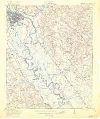
Augusta, SC
Old map for history, not navigation
USGS historical 15-minute topo (1921)

Augusta, SC
Old map for history, not navigation
USGS historical 15-minute topo (1943)

Bamberg, SC
Old map for history, not navigation
USGS historical 15-minute topo (1920)

Bamberg, SC
Old map for history, not navigation
USGS historical 15-minute topo (1943)

Bluffton, SC
Old map for history, not navigation
USGS historical 15-minute topo (1945)

Bonneau, SC
Old map for history, not navigation
USGS historical 15-minute topo (1943)

Bowman, SC
Old map for history, not navigation
USGS historical 15-minute topo (1921)

Bowman, SC
Old map for history, not navigation
USGS historical 15-minute topo (1943)

Camden, SC
Old map for history, not navigation
USGS historical 15-minute topo (1935)
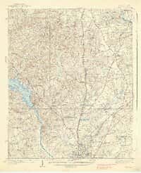
Camden, SC
Old map for history, not navigation
USGS historical 15-minute topo (1938)

Chicora, SC
Old map for history, not navigation
USGS historical 15-minute topo (1921)

Chicora, SC
Old map for history, not navigation
USGS historical 15-minute topo (1943)

Clarks Hill, SC
Old map for history, not navigation
USGS historical 15-minute topo (1921)

Clarks Hill, SC
Old map for history, not navigation
USGS historical 15-minute topo (1941)

Clarks Hill, SC
Old map for history, not navigation
USGS historical 15-minute topo (1942)
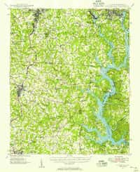
Clover, SC
Old map for history, not navigation
USGS historical 15-minute topo (1947)

Clover, SC
Old map for history, not navigation
USGS historical 15-minute topo (1949)

Cottageville, SC
Old map for history, not navigation
USGS historical 15-minute topo (1918)

Cottageville, SC
Old map for history, not navigation
USGS historical 15-minute topo (1943)

Cowpens, SC
Old map for history, not navigation
USGS historical 15-minute topo (1959)

Cummings, SC
Old map for history, not navigation
USGS historical 15-minute topo (1919)

Cummings, SC
Old map for history, not navigation
USGS historical 15-minute topo (1943)

Easley, SC
Old map for history, not navigation
USGS historical 15-minute topo (1957)

Eastover, SC
Old map for history, not navigation
USGS historical 15-minute topo (1943)

Edisto Island, SC
Old map for history, not navigation
USGS historical 15-minute topo (1919)

Edisto Island, SC
Old map for history, not navigation
USGS historical 15-minute topo (1943)

Edmund, SC
Old map for history, not navigation
USGS historical 15-minute topo (1944)

Ellenton, SC
Old map for history, not navigation
USGS historical 15-minute topo (1921)

Ellenton, SC
Old map for history, not navigation
USGS historical 15-minute topo (1944)

Elloree, SC
Old map for history, not navigation
USGS historical 15-minute topo (1946)

Eutawville, SC
Old map for history, not navigation
USGS historical 15-minute topo (1921)

Eutawville, SC
Old map for history, not navigation
USGS historical 15-minute topo (1943)
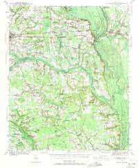
Florence East, SC
Old map for history, not navigation
USGS historical 15-minute topo (1940)
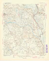
Florence East, SC
Old map for history, not navigation
USGS historical 15-minute topo (1945)

Florence West, SC
Old map for history, not navigation
USGS historical 15-minute topo (1940)

Florence West, SC
Old map for history, not navigation
USGS historical 15-minute topo (1945)

Fort Fremont, SC
Old map for history, not navigation
USGS historical 15-minute topo (1944)

Fort Fremont, SC
Old map for history, not navigation
USGS historical 15-minute topo (1959)

Fountain Inn, SC
Old map for history, not navigation
USGS historical 15-minute topo (1957)

Gaffney, SC
Old map for history, not navigation
USGS historical 15-minute topo (1909)

Gilbert, SC
Old map for history, not navigation
USGS historical 15-minute topo (1944)

Green Pond, SC
Old map for history, not navigation
USGS historical 15-minute topo (1918)
Every South Carolina historical topo map by name
- Aiken, SC (1921)
- Aiken, SC (1943)
- Allendale, SC (1919)
- Allendale, SC (1943)
- Anderson, SC (1957)
- Ashwood, SC (1957)
- Augusta, SC (1921)
- Augusta, SC (1943)
- Bamberg, SC (1920)
- Bamberg, SC (1943)
- Bluffton, SC (1945)
- Bonneau, SC (1943)
- Bowman, SC (1921)
- Bowman, SC (1943)
- Camden, SC (1935)
- Camden, SC (1938)
- Chicora, SC (1921)
- Chicora, SC (1943)
- Clarks Hill, SC (1921)
- Clarks Hill, SC (1941)
- Clarks Hill, SC (1942)
- Clover, SC (1947)
- Clover, SC (1949)
- Cottageville, SC (1918)
- Cottageville, SC (1943)
- Cowpens, SC (1959)
- Cummings, SC (1919)
- Cummings, SC (1943)
- Easley, SC (1957)
- Eastover, SC (1943)
- Edisto Island, SC (1919)
- Edisto Island, SC (1943)
- Edmund, SC (1944)
- Ellenton, SC (1921)
- Ellenton, SC (1944)
- Elloree, SC (1946)
- Eutawville, SC (1921)
- Eutawville, SC (1943)
- Florence East, SC (1940)
- Florence East, SC (1945)
- Florence West, SC (1940)
- Florence West, SC (1945)
- Fort Fremont, SC (1944)
- Fort Fremont, SC (1959)
- Fountain Inn, SC (1957)
- Gaffney, SC (1909)
- Gilbert, SC (1944)
- Green Pond, SC (1918)
- Green Pond, SC (1943)
- Greenville, SC (1938)
- Greenville, SC (1957)
- Greer, SC (1938)
- Greer, SC (1957)
- Gum Swamp, SC (1943)
- Hagood, SC (1938)
- Hardeeville, SC (1953)
- Hilltonia, SC (1920)
- Hilton Head, SC (1920)
- Hilton Head, SC (1945)
- Hopkins, SC (1948)
- Hyman, SC (1946)
- Indiantown, SC (1946)
- Inman, SC (1961)
- Johnsonville, SC (1946)
- Killian, SC (1935)
- Killian, SC (1937)
- Kings Mountain, SC (1906)
- Kings Mountain, SC (1908)
- Kingstree, SC (1946)
- Lake City, SC (1946)
- Lodge, SC (1919)
- Lodge, SC (1921)
- Lodge, SC (1943)
- Manning, SC (1921)
- Manning, SC (1944)
- Mayesville, SC (1921)
- Mayesville, SC (1943)
- Myrtle Beach, SC (1937)
- Myrtle Beach, SC (1940)
- Nixonville, SC (1937)
- Nixonville, SC (1942)
- Okatie, SC (1920)
- Okatie, SC (1942)
- Olar, SC (1919)
- Olar, SC (1943)
- Orangeburg, SC (1921)
- Orangeburg, SC (1943)
- Peeples, SC (1920)
- Peeples, SC (1943)
- Pineland, SC (1919)
- Pineland, SC (1943)
- Ravenels, SC (1920)
- Ravenels, SC (1944)
- Ridgeville, SC (1920)
- Ridgeville, SC (1943)
- Rock Hill, SC (1949)
- Savannah, SC (1942)
- Seivern, SC (1944)
- Sharon, SC (1907)
- Shirley, SC (1919)
- Shirley, SC (1943)
- Spartanburg, SC (1947)
- Spartanburg, SC (1949)
- St George, SC (1921)
- St George, SC (1944)
- St Helena Sound, SC (1920)
- St Helena Sound, SC (1948)
- St Matthews, SC (1946)
- Summerton, SC (1971)
- Summerville, SC (1920)
- Summerville, SC (1944)
- Sumter, SC (1946)
- Sumter, SC (1957)
- Tabor City, SC (1962)
- Talatha, SC (1921)
- Talatha, SC (1943)
- Tigerville, SC (1959)
- Varnville, SC (1918)
- Varnville, SC (1944)
- Wadmelaw Island, SC (1919)
- Wadmelaw Island, SC (1944)
- Walterboro, SC (1918)
- Walterboro, SC (1943)
- Warrenville, SC (1923)
- Warrenville, SC (1928)
- Warrenville, SC (1943)
- Williamston, SC (1957)
- Williston, SC (1927)
- Williston, SC (1943)
- Woodford, SC (1946)
- Yemassee, SC (1918)
- Yemassee, SC (1943)