Montana national forest maps
Cartahaven has 61 national forest maps of Montana, all free. Forest visitor maps, motor vehicle use maps and winter travel maps from the USDA Forest Service: which roads and trails are open, to what, and when.
Download one to your phone and the map app shows your GPS position on it with no cell signal.

Beaverhead-Deerlodge National Forest
Forest Service forest map

Benchmark/Beaver/Willow Areas Over-Snow Vehicle Use Map (sheet)
Where snowmobiles are allowed
Helena-Lewis and Clark National Forest (2019)

Big & Little Snowy Mountains Over-Snow Vehicle Use Map
Where snowmobiles are allowed
Helena-Lewis and Clark National Forest (2019)

Big Belt Mountains, North Half Over-Snow Vehicle Use Map (sheet)
Where snowmobiles are allowed
Helena-Lewis and Clark National Forest (2019)

Big Belt Mountains, South Half Over-Snow Vehicle Use Map (sheet)
Where snowmobiles are allowed
Helena-Lewis and Clark National Forest (2019)

Birch Creek Ski Trail Map
Beaverhead-Deerlodge National Forest

Bitterroot National Forest
Forest Service forest map

Castle Mountains Over-Snow Vehicle Use Map (sheet)
Where snowmobiles are allowed
Helena-Lewis and Clark National Forest (2019)

Central East Over-Snow Vehicle Use Map
Where snowmobiles are allowed
Beaverhead-Deerlodge National Forest

Central West Over-Snow Vehicle Use Map
Where snowmobiles are allowed
Beaverhead-Deerlodge National Forest

Crazy Mountains Over-Snow Vehicle Use Map (sheet)
Where snowmobiles are allowed
Helena-Lewis and Clark National Forest (2019)

Custer Gallatin National Forest
Custer West — Forest Service forest map

Custer Gallatin National Forest
Gallatin — Forest Service forest map

Custer Gallatin National Forest- Custer Central
Forest Service forest map

Custer Gallatin National Forest- Custer East
Forest Service forest map

Darby Ranger District Motor Vehicle Use Map (MVUM)
Forest roads and trails open to vehicles
Bitterroot National Forest (2026)

Divide, North Half Over-Snow Vehicle Use Map (sheet)
Where snowmobiles are allowed
Helena-Lewis and Clark National Forest (2019)

Divide, South Half Over-Snow Vehicle Use Map (sheet)
Where snowmobiles are allowed
Helena-Lewis and Clark National Forest (2019)

East Side Crazy Mountains Forest Visitor Map insert
Custer Gallatin National Forest (2026)

Elkhorn Hot Springs Ski Trail Map
Beaverhead-Deerlodge National Forest

Elkhorn Mountains Over-Snow Vehicle Use Map (sheet)
Where snowmobiles are allowed
Helena-Lewis and Clark National Forest (2019)

Flathead National Forest
Forest Service forest map

Helena and Townsend Ranger Districts Over-Snow Vehicle Use Map
Where snowmobiles are allowed
Helena-Lewis and Clark National Forest (2019)

Helena-Lewis and Clark National Forest
East — Forest Service forest map

Helena-Lewis and Clark National Forest
West — Forest Service forest map

Highwood Mountains Over-Snow Vehicle Use Map
Where snowmobiles are allowed
Helena-Lewis and Clark National Forest (2019)

Kings Hill Snowmobile Trail System Map
Helena-Lewis and Clark National Forest (2016)

Kootenai National Forest
Forest Service forest map

Lincoln Ranger District Motor Vehicle Use Map (MVUM)
Forest roads and trails open to vehicles
Helena-Lewis and Clark National Forest (2023)

Lincoln Ranger District Over-Snow Vehicle Use Map
Where snowmobiles are allowed
Helena-Lewis and Clark National Forest (2021)

Little Belt Mountains, East Side Over-Snow Vehicle Use Map (sheet)
Where snowmobiles are allowed
Helena-Lewis and Clark National Forest (2019)

Little Belt Mountains, West Side Over-Snow Vehicle Use Map (sheet)
Where snowmobiles are allowed
Helena-Lewis and Clark National Forest (2019)

Little Belt, Castle, and Crazy Mountains Over-Snow Vehicle Use Map
Where snowmobiles are allowed
Helena-Lewis and Clark National Forest (2019)

Lolo National Forest
Forest Service forest map

Map #4
Where snowmobiles are allowed
Powell Area Over-Snow Vehicle Use Map — Nez Perce-Clearwater National Forests (2018)

Missoula Ranger District OSVUM
Where snowmobiles are allowed
Lolo National Forest

Missoula West Motor Vehicle Use Map (MVUM)
Forest roads and trails open to vehicles
Lolo National Forest
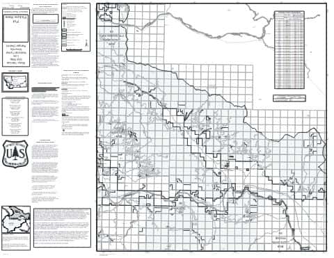
Ninemile North Motor Vehicle Use Map (MVUM)
Forest roads and trails open to vehicles
Lolo National Forest

Ninemile Ranger District OSVUM
Where snowmobiles are allowed
Lolo National Forest

Ninemile South Motor Vehicle Use Map (MVUM)
Forest roads and trails open to vehicles
Lolo National Forest

North East Over-Snow Vehicle Use Map
Where snowmobiles are allowed
Beaverhead-Deerlodge National Forest

North Gravelly Mountains Motor Vehicle Use Map (MVUM)
Forest roads and trails open to vehicles
Beaverhead-Deerlodge National Forest (2017)

North Over-Snow Vehicle Use Map
Where snowmobiles are allowed
Bitterroot National Forest

North West Over-Snow Vehicle Use Map
Where snowmobiles are allowed
Beaverhead-Deerlodge National Forest

Plains Ranger District OSVUM
Where snowmobiles are allowed
Lolo National Forest

Plains/Thompson Falls RD Motor Vehicle Use Map (MVUM)
Forest roads and trails open to vehicles
Lolo National Forest

Porcupine Ibex Forest Visitor Map Insert
Custer Gallatin National Forest (2021)

Rock Creek Motor Vehicle Use Map (MVUM)
Forest roads and trails open to vehicles
Lolo National Forest

Rocky Mountain Ranger District Over-Snow Vehicle Use Map
Where snowmobiles are allowed
Helena-Lewis and Clark National Forest (2019)

Seeley Lake Ranger District OSVUM
Where snowmobiles are allowed
Lolo National Forest

Seeley Lake RD Motor Vehicle Use Map (MVUM)
Forest roads and trails open to vehicles
Lolo National Forest

South East Over-Snow Vehicle Use Map
Where snowmobiles are allowed
Beaverhead-Deerlodge National Forest

South Gravelly Mountains Motor Vehicle Use Map (MVUM)
Forest roads and trails open to vehicles
Beaverhead-Deerlodge National Forest (2017)

South Over-Snow Vehicle Use Map
Where snowmobiles are allowed
Bitterroot National Forest

South West Over-Snow Vehicle Use Map
Where snowmobiles are allowed
Beaverhead-Deerlodge National Forest

Stevensville Ranger District Motor Vehicle Use Map (MVUM)
Forest roads and trails open to vehicles
Bitterroot National Forest (2026)

Sula Ranger District Motor Vehicle Use Map (MVUM)
Forest roads and trails open to vehicles
Bitterroot National Forest (2026)

Superior Ranger District OSVUM
Where snowmobiles are allowed
Lolo National Forest

Superior RD Motor Vehicle Use Map (MVUM)
Forest roads and trails open to vehicles
Lolo National Forest

Teton River Area Over-Snow Vehicle Use Map (sheet)
Where snowmobiles are allowed
Helena-Lewis and Clark National Forest (2019)

Tobacco Root Mountains Motor Vehicle Use Map (MVUM)
Forest roads and trails open to vehicles
Beaverhead-Deerlodge National Forest (2017)