Montana historical topo maps
Cartahaven has 175 historical topo maps of Montana, all free. These are the USGS 15-minute (1:62,500) quadrangles from the mid-1900s: old roads, mines, homesteads, rail lines and place names that newer maps leave off.
Download one to your phone and the map app shows your GPS position on it with no cell signal.

Alberton, MT
Old map for history, not navigation
USGS historical 15-minute topo (1959)

Alpine, MT
Old map for history, not navigation
USGS historical 15-minute topo (1956)

Anaconda, MT
Old map for history, not navigation
USGS historical 15-minute topo (1961)

Anceney, MT
Old map for history, not navigation
USGS historical 15-minute topo (1949)

Antelope Coulee, MT
Old map for history, not navigation
USGS historical 15-minute topo (1943)

Arlee, MT
Old map for history, not navigation
USGS historical 15-minute topo (1959)

Assinniboine, MT
Old map for history, not navigation
USGS historical 15-minute topo (1904)

Avon, MT
Old map for history, not navigation
USGS historical 15-minute topo (1958)

Barker, MT
Old map for history, not navigation
USGS historical 15-minute topo (1961)

Basin, MT
Old map for history, not navigation
USGS historical 15-minute topo (1954)

Bearmouth, MT
Old map for history, not navigation
USGS historical 15-minute topo (1959)

Belgrade, MT
Old map for history, not navigation
USGS historical 15-minute topo (1950)

Belt, MT
Old map for history, not navigation
USGS historical 15-minute topo (1956)

Boulder, MT
Old map for history, not navigation
USGS historical 15-minute topo (1954)
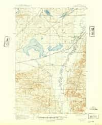
Bowdoin, MT
Old map for history, not navigation
USGS historical 15-minute topo (1905)

Boxelder, MT
Old map for history, not navigation
USGS historical 15-minute topo (1904)

Boxelder, MT
Old map for history, not navigation
USGS historical 15-minute topo (1906)

Bozeman Pass, MT
Old map for history, not navigation
USGS historical 15-minute topo (1951)

Bozeman, MT
Old map for history, not navigation
USGS historical 15-minute topo (1953)
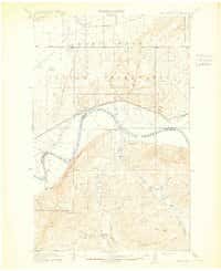
Brockton, MT
Old map for history, not navigation
USGS historical 15-minute topo (1914)

Butte North, MT
Old map for history, not navigation
USGS historical 15-minute topo (1959)

Butte South, MT
Old map for history, not navigation
USGS historical 15-minute topo (1961)

Bynum, MT
Old map for history, not navigation
USGS historical 15-minute topo (1960)

Cameron, MT
Old map for history, not navigation
USGS historical 15-minute topo (1950)

Canyon Ferry, MT
Old map for history, not navigation
USGS historical 15-minute topo (1950)

Cascade, MT
Old map for history, not navigation
USGS historical 15-minute topo (1949)

Cascade, MT
Old map for history, not navigation
USGS historical 15-minute topo (1951)

Centennial Mountain, MT
Old map for history, not navigation
USGS historical 15-minute topo (1959)

Chelsea, MT
Old map for history, not navigation
USGS historical 15-minute topo (1912)

Chinook, MT
Old map for history, not navigation
USGS historical 15-minute topo (1904)

Choteau, MT
Old map for history, not navigation
USGS historical 15-minute topo (1960)

Clancy, MT
Old map for history, not navigation
USGS historical 15-minute topo (1950)

Cleveland Mountain, MT
Old map for history, not navigation
USGS historical 15-minute topo (1959)

Cleveland, MT
Old map for history, not navigation
USGS historical 15-minute topo (1956)

Cliff Lake, MT
Old map for history, not navigation
USGS historical 15-minute topo (1950)

Collins Ranch, MT
Old map for history, not navigation
USGS historical 15-minute topo (1958)

Collins, MT
Old map for history, not navigation
USGS historical 15-minute topo (1950)

Cooke City, MT
Old map for history, not navigation
USGS historical 15-minute topo (1956)

Cooper Gulch, MT
Old map for history, not navigation
USGS historical 15-minute topo (1956)

Crown Butte, MT
Old map for history, not navigation
USGS historical 15-minute topo (1955)

Cuskers, MT
Old map for history, not navigation
USGS historical 15-minute topo (1910)

Cuskers, MT
Old map for history, not navigation
USGS historical 15-minute topo (1915)

Cutoff Mtn, MT
Old map for history, not navigation
USGS historical 15-minute topo (1942)

Cutoff Mtn, MT
Old map for history, not navigation
USGS historical 15-minute topo (1944)

Deer Lodge, MT
Old map for history, not navigation
USGS historical 15-minute topo (1959)

Dent Bridge, MT
Old map for history, not navigation
USGS historical 15-minute topo (1950)

Devils Fence, MT
Old map for history, not navigation
USGS historical 15-minute topo (1950)

Drummond, MT
Old map for history, not navigation
USGS historical 15-minute topo (1958)
Every Montana historical topo map by name
- Alberton, MT (1959)
- Alpine, MT (1956)
- Anaconda, MT (1961)
- Anceney, MT (1949)
- Antelope Coulee, MT (1943)
- Arlee, MT (1959)
- Assinniboine, MT (1904)
- Avon, MT (1958)
- Barker, MT (1961)
- Basin, MT (1954)
- Bearmouth, MT (1959)
- Belgrade, MT (1950)
- Belt, MT (1956)
- Boulder, MT (1954)
- Bowdoin, MT (1905)
- Boxelder, MT (1904)
- Boxelder, MT (1906)
- Bozeman Pass, MT (1951)
- Bozeman, MT (1953)
- Brockton, MT (1914)
- Butte North, MT (1959)
- Butte South, MT (1961)
- Bynum, MT (1960)
- Cameron, MT (1950)
- Canyon Ferry, MT (1950)
- Cascade, MT (1949)
- Cascade, MT (1951)
- Centennial Mountain, MT (1959)
- Chelsea, MT (1912)
- Chinook, MT (1904)
- Choteau, MT (1960)
- Clancy, MT (1950)
- Cleveland Mountain, MT (1959)
- Cleveland, MT (1956)
- Cliff Lake, MT (1950)
- Collins Ranch, MT (1958)
- Collins, MT (1950)
- Cooke City, MT (1956)
- Cooper Gulch, MT (1956)
- Crown Butte, MT (1955)
- Cuskers, MT (1910)
- Cuskers, MT (1915)
- Cutoff Mtn, MT (1942)
- Cutoff Mtn, MT (1944)
- Deer Lodge, MT (1959)
- Dent Bridge, MT (1950)
- Devils Fence, MT (1950)
- Drummond, MT (1958)
- Duck Creek Pass, MT (1950)
- Dutton, MT (1950)
- East Helena, MT (1950)
- Elk Park, MT (1954)
- Elliston, MT (1959)
- Emigrant, MT (1955)
- Ennis, MT (1949)
- Fairfield, MT (1950)
- Frazer, MT (1915)
- Freezeout Lake, MT (1960)
- Fridley Peak, MT (1955)
- Gallup City, MT (1938)
- Gallup City, MT (1942)
- Gardiner, MT (1955)
- Garnet Mountain, MT (1955)
- Garrison, MT (1958)
- Gilman, MT (1960)
- Gore Hill, MT (1955)
- Grant, MT (1959)
- Great Falls, MT (1949)
- Great Falls, MT (1951)
- Harlem, MT (1905)
- Harrison, MT (1950)
- Haugan, MT (1957)
- Havre, MT (1904)
- Hay Creek, MT (1912)
- Hebgen Dam, MT (1950)
- Helena Special, MT (1899)
- Helena, MT (1950)
- Highwood, MT (1956)
- Hinsdale Special Map, MT (1906)
- Homestead, MT (1914)
- Illinois Peak, MT (1957)
- Jefferson City, MT (1950)
- Jefferson Island, MT (1950)
- Judith Peak, MT (1941)
- Judith Peak, MT (1944)
- Kremlin, MT (1906)
- Lake Frances, MT (1937)
- Laredo, MT (1959)
- Lewistown, MT (1941)
- Lewistown, MT (1944)
- Lloyd, MT (1956)
- Lonesome, MT (1906)
- Lower Red Rock Lake, MT (1950)
- Maddux, MT (1956)
- Maloney Hill, MT (1958)
- Manhattan, MT (1949)
- Maudlow, MT (1949)
- Miller Coulee, MT (1958)
- Miner, MT (1955)
- Monument Ridge, MT (1950)
- Mount Maurice, MT (1956)
- Mt Cowen, MT (1940)
- Mt Cowen, MT (1943)
- Mt Douglas, MT (1941)
- Mt Douglas, MT (1943)
- Mt Wallace, MT (1940)
- Mt Wallace, MT (1943)
- Mt Wood, MT (1939)
- Mt Wood, MT (1941)
- Nashua, MT (1914)
- Nashua, MT (1916)
- Neihart, MT (1961)
- Norris, MT (1949)
- Norris, MT (1951)
- Oswego, MT (1915)
- Painted Rocks Lake, MT (1960)
- Pendroy, MT (1936)
- Pendroy, MT (1941)
- Perma, MT (1959)
- Piquett Mtn, MT (1960)
- Plains, MT (1959)
- Polaris, MT (1959)
- Poplar, MT (1912)
- Porcupine Valley, MT (1918)
- Portage, MT (1948)
- Portage, MT (1949)
- Radersburg, MT (1949)
- Rattlesnake, MT (1956)
- Ravenna, MT (1959)
- Red Lodge, MT (1944)
- Saco Special, MT (1905)
- Saltese, MT (1956)
- Sedan, MT (1951)
- Shambo, MT (1959)
- Shelby, MT (1943)
- Simms, MT (1960)
- Smoke Creek, MT (1909)
- Smoke Creek, MT (1912)
- Spanish Peaks, MT (1950)
- Sphinx Mountain, MT (1950)
- Spring Creek, MT (1915)
- St Regis, MT (1956)
- Stockett, MT (1955)
- Straight Peak, MT (1960)
- Sunburst, MT (1939)
- Superior, MT (1960)
- Tarkio, MT (1959)
- Tepee Creek, MT (1958)
- Thompson Falls, MT (1937)
- Thompson Falls, MT (1957)
- Three Forks, MT (1950)
- Timber Coulee, MT (1949)
- Timber Coulee, MT (1950)
- Todd Lakes, MT (1910)
- Todd Lakes, MT (1915)
- Toston, MT (1949)
- Townsend, MT (1950)
- Tule Valley, MT (1915)
- Twin Bridges, MT (1960)
- Upper Red Rock Lake, MT (1950)
- Valier, MT (1934)
- Valier, MT (1937)
- Varney, MT (1949)
- Vaughn, MT (1949)
- Vaughn, MT (1952)
- Vipond Park, MT (1958)
- Virginia City, MT (1950)
- Warrick, MT (1959)
- Waterloo, MT (1960)
- Wayne Creek, MT (1903)
- Wayne Creek, MT (1905)
- West Butte, MT (1945)
- West Yellowstone, MT (1958)
- Wolf Point, MT (1916)
- Yantic, MT (1904)