Minnesota wildlife refuge maps
Cartahaven has 35 wildlife refuge maps of Minnesota, all free. Maps from the U.S. Fish and Wildlife Service for national wildlife refuges: hunt areas, closed zones, parking and access.
Download one to your phone and the map app shows your GPS position on it with no cell signal.

Bloomington Ferry and Wilkie Units trail map at Bloomington and Shakopee
Minnesota Valley National Wildlife Refuge (2026)

Cobb River WPA (2018)
Minnesota Valley Wetland Management District

Dehning WPA (2022)
Minnesota Valley Wetland Management District

Delehanty WPA (2018)
Minnesota Valley Wetland Management District

Dodge Center Creek WPA (2018)
Minnesota Valley Wetland Management District

Evans Slough WPA (2018)
Minnesota Valley Wetland Management District

Fickling WPA (2018)
Minnesota Valley Wetland Management District

Georeferenced Hunting Map for Minnesota Valley National Wildlife Refuge (2024)
Fish & Wildlife Service Refuge Maps

Georeferenced Trail Map of Bloomington Ferry and Wilkie Units, Minnesota Valley NWR (2022)
Fish & Wildlife Service Refuge Maps

Georeferenced Trail Map of Long Meadow Lake and Black Dog Units, Minnesota Valley NWR (2022)
Fish & Wildlife Service Refuge Maps

Georeferenced Trail Map of Rapids Lake, Chaska and Louisville Swamp Units, Minnesota Valley NWR (2022)
Fish & Wildlife Service Refuge Maps

Hahn Lake WPA (2018)
Minnesota Valley Wetland Management District

Hartung WPA (2018)
Minnesota Valley Wetland Management District

High Island WPA (2021)
Minnesota Valley Wetland Management District

Hurley WPA (2022)
Minnesota Valley Wetland Management District

Lincoln WPA (2018)
Minnesota Valley Wetland Management District

Minnesota Pheasants WPA (2018)
Minnesota Valley Wetland Management District

Mud Lake WPA (2018)
Minnesota Valley Wetland Management District

Perbix WPA (2018)
Minnesota Valley Wetland Management District

Perch Lake WPA (2018)
Minnesota Valley Wetland Management District

Preuss WPA (2018)
Minnesota Valley Wetland Management District

Redhead WPA (2018)
Minnesota Valley Wetland Management District

Robert Kaul WPA (2018)
Minnesota Valley Wetland Management District

Roberts WPA (2018)
Minnesota Valley Wetland Management District

Round Lake Unit, Minnesota Valley NWR
Fish & Wildlife Service Refuge Maps

Rydell Trail Map (2023)
Fish & Wildlife Service Refuge Maps

Shelby WPA (2018)
Minnesota Valley Wetland Management District

Soberg WPA (2018)
Minnesota Valley Wetland Management District

Straight Creek WPA (2018)
Minnesota Valley Wetland Management District

Straight River Marsh WPA (2018)
Minnesota Valley Wetland Management District

Strom Lake WPA (2019)
Minnesota Valley Wetland Management District

Tiger Lake WPA (2021)
Minnesota Valley Wetland Management District
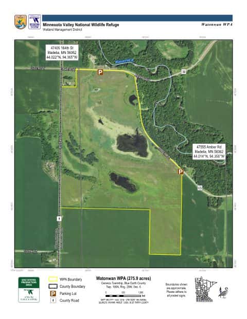
Watonwan WPA (2018)
Minnesota Valley Wetland Management District

Willow Creek WPA (2018)
Minnesota Valley Wetland Management District

Wolf Creek WPA (2018)
Minnesota Valley Wetland Management District