West Virginia historical topo maps
Cartahaven has 287 historical topo maps of West Virginia, all free. These are the USGS 15-minute (1:62,500) quadrangles from the mid-1900s: old roads, mines, homesteads, rail lines and place names that newer maps leave off.
Download one to your phone and the map app shows your GPS position on it with no cell signal.

Alderson, WV
Old map for history, not navigation
USGS historical 15-minute topo (1921)

Alderson, WV
Old map for history, not navigation
USGS historical 15-minute topo (1923)

Arnoldsburg, WV
Old map for history, not navigation
USGS historical 15-minute topo (1907)

Arnoldsburg, WV
Old map for history, not navigation
USGS historical 15-minute topo (1925)

Arnoldsburg, WV
Old map for history, not navigation
USGS historical 15-minute topo (1927)

Bald Knob, WV
Old map for history, not navigation
USGS historical 15-minute topo (1912)

Bald Knob, WV
Old map for history, not navigation
USGS historical 15-minute topo (1928)

Bald Knob, WV
Old map for history, not navigation
USGS historical 15-minute topo (1931)

Beckley, WV
Old map for history, not navigation
USGS historical 15-minute topo (1913)

Beckley, WV
Old map for history, not navigation
USGS historical 15-minute topo (1929)

Beckley, WV
Old map for history, not navigation
USGS historical 15-minute topo (1932)

Belington, WV
Old map for history, not navigation
USGS historical 15-minute topo (1907)

Belington, WV
Old map for history, not navigation
USGS historical 15-minute topo (1927)

Belington, WV
Old map for history, not navigation
USGS historical 15-minute topo (1941)

Belleville, WV
Old map for history, not navigation
USGS historical 15-minute topo (1906)

Belleville, WV
Old map for history, not navigation
USGS historical 15-minute topo (1924)

Belleville, WV
Old map for history, not navigation
USGS historical 15-minute topo (1926)

Berryville, WV
Old map for history, not navigation
USGS historical 15-minute topo (1916)

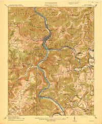
Big Bend, WV
Old map for history, not navigation
USGS historical 15-minute topo (1912)
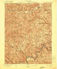
Big Bend, WV
Old map for history, not navigation
USGS historical 15-minute topo (1914)
Blacksville, WV
Old map for history, not navigation
USGS historical 15-minute topo (1904)

Blacksville, WV
Old map for history, not navigation
USGS historical 15-minute topo (1923)
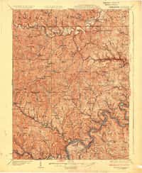
Blacksville, WV
Old map for history, not navigation
USGS historical 15-minute topo (1925)

Bluefield, WV
Old map for history, not navigation
USGS historical 15-minute topo (1916)

Bluefield, WV
Old map for history, not navigation
USGS historical 15-minute topo (1924)

Bluefield, WV
Old map for history, not navigation
USGS historical 15-minute topo (1926)

Bramwell, WV
Old map for history, not navigation
USGS historical 15-minute topo (1924)

Bramwell, WV
Old map for history, not navigation
USGS historical 15-minute topo (1925)

Bruceton Mills, WV
Old map for history, not navigation
USGS historical 15-minute topo (1931)

Bruceton, WV
Old map for history, not navigation
USGS historical 15-minute topo (1904)

Bruceton, WV
Old map for history, not navigation
USGS historical 15-minute topo (1926)

Bruceton, WV
Old map for history, not navigation
USGS historical 15-minute topo (1933)

Burnsville, WV
Old map for history, not navigation
USGS historical 15-minute topo (1906)

Burnsville, WV
Old map for history, not navigation
USGS historical 15-minute topo (1925)

Burnsville, WV
Old map for history, not navigation
USGS historical 15-minute topo (1927)

Cameron, WV
Old map for history, not navigation
USGS historical 15-minute topo (1904)

Cameron, WV
Old map for history, not navigation
USGS historical 15-minute topo (1935)

Cameron, WV
Old map for history, not navigation
USGS historical 15-minute topo (1942)

Capon Bridge, WV
Old map for history, not navigation
USGS historical 15-minute topo (1916)

Capon Bridge, WV
Old map for history, not navigation
USGS historical 15-minute topo (1923)

Capon Bridge, WV
Old map for history, not navigation
USGS historical 15-minute topo (1937)

Capon Bridge, WV
Old map for history, not navigation
USGS historical 15-minute topo (1943)

Cass, WV
Old map for history, not navigation
USGS historical 15-minute topo (1922)

Cass, WV
Old map for history, not navigation
USGS historical 15-minute topo (1924)

Centerpoint, WV
Old map for history, not navigation
USGS historical 15-minute topo (1905)

Centerpoint, WV
Old map for history, not navigation
USGS historical 15-minute topo (1924)

Centerpoint, WV
Old map for history, not navigation
USGS historical 15-minute topo (1925)

Charleston, WV
Old map for history, not navigation
USGS historical 15-minute topo (1909)
Every West Virginia historical topo map by name
- Alderson, WV (1921)
- Alderson, WV (1923)
- Arnoldsburg, WV (1907)
- Arnoldsburg, WV (1925)
- Arnoldsburg, WV (1927)
- Bald Knob, WV (1912)
- Bald Knob, WV (1928)
- Bald Knob, WV (1931)
- Beckley, WV (1913)
- Beckley, WV (1929)
- Beckley, WV (1932)
- Belington, WV (1907)
- Belington, WV (1927)
- Belington, WV (1941)
- Belleville, WV (1906)
- Belleville, WV (1924)
- Belleville, WV (1926)
- Berryville, WV (1916)
- Big Bend, WV (1912)
- Big Bend, WV (1914)
- Blacksville, WV (1904)
- Blacksville, WV (1923)
- Blacksville, WV (1925)
- Bluefield, WV (1916)
- Bluefield, WV (1924)
- Bluefield, WV (1926)
- Bramwell, WV (1924)
- Bramwell, WV (1925)
- Bruceton Mills, WV (1931)
- Bruceton, WV (1904)
- Bruceton, WV (1926)
- Bruceton, WV (1933)
- Burnsville, WV (1906)
- Burnsville, WV (1925)
- Burnsville, WV (1927)
- Cameron, WV (1904)
- Cameron, WV (1935)
- Cameron, WV (1942)
- Capon Bridge, WV (1916)
- Capon Bridge, WV (1923)
- Capon Bridge, WV (1937)
- Capon Bridge, WV (1943)
- Cass, WV (1922)
- Cass, WV (1924)
- Centerpoint, WV (1905)
- Centerpoint, WV (1924)
- Centerpoint, WV (1925)
- Charleston, WV (1909)
- Charleston, WV (1931)
- Charleston, WV (1935)
- Charleston, WV (1936)
- Circleville, WV (1922)
- Circleville, WV (1924)
- Clarksburg, WV (1902)
- Clarksburg, WV (1910)
- Clarksburg, WV (1923)
- Clarksburg, WV (1925)
- Clay, WV (1908)
- Clay, WV (1910)
- Clendenin, WV (1907)
- Clendenin, WV (1909)
- Clifton Forge, WV (1949)
- Clintonville, WV (1923)
- Clintonville, WV (1935)
- Clintonville, WV (1939)
- Cowen, WV (1915)
- Cowen, WV (1917)
- Crawford, WV (1912)
- Crawford, WV (1914)
- Davis, WV (1918)
- Davis, WV (1919)
- Davis, WV (1921)
- Durbin, WV (1922)
- Durbin, WV (1924)
- Eccles, WV (1914)
- Eccles, WV (1929)
- Eccles, WV (1932)
- Edinburg, WV (1923)
- Elizabeth, WV (1906)
- Elizabeth, WV (1924)
- Elizabeth, WV (1926)
- Elk Garden, WV (1919)
- Elk Garden, WV (1922)
- Elkins, WV (1909)
- Fairmont, WV (1902)
- Fairmont, WV (1923)
- Fairmont, WV (1926)
- Fayetteville, WV (1910)
- Fayetteville, WV (1928)
- Fayetteville, WV (1931)
- Flattop, WV (1914)
- Flattop, WV (1929)
- Flattop, WV (1932)
- Fort Seybert, WV (1924)
- Fort Seybert, WV (1947)
- Fort Seybert, WV (1951)
- Gassaway, WV (1910)
- Gerrardstown, WV (1916)
- Gerrardstown, WV (1937)
- Gerrardstown, WV (1943)
- Gilbert, WV (1912)
- Gilbert, WV (1925)
- Gilbert, WV (1927)
- Glenville, WV (1906)
- Glenville, WV (1925)
- Glenville, WV (1928)
- Glenwood, WV (1906)
- Glenwood, WV (1908)
- Greenland Gap, WV (1921)
- Guyandot, WV (1901)
- Guyandot, WV (1902)
- Hacker Valley, WV (1915)
- Hancock, WV (1899)
- Hanging Rock, WV (1921)
- Hanging Rock, WV (1923)
- Harrisville, WV (1907)
- Harrisville, WV (1924)
- Harrisville, WV (1926)
- Holbrook, WV (1906)
- Holbrook, WV (1924)
- Holbrook, WV (1926)
- Holden, WV (1912)
- Holden, WV (1926)
- Holden, WV (1928)
- Horton, WV (1924)
- Iaeger, WV (1912)
- Iaeger, WV (1916)
- Iaeger, WV (1927)
- Kenna, WV (1906)
- Kenna, WV (1907)
- Keyser, WV (1920)
- Keyser, WV (1922)
- Kingwood, WV (1907)
- Kingwood, WV (1925)
- Littleton, WV (1903)
- Littleton, WV (1905)
- Littleton, WV (1924)
- Littleton, WV (1926)
- Lobelia, WV (1925)
- Lobelia, WV (1935)
- Lobelia, WV (1939)
- Logan, WV (1913)
- Logan, WV (1926)
- Logan, WV (1928)
- Louisa, WV (1913)
- Madison, WV (1911)
- Madison, WV (1929)
- Madison, WV (1931)
- Mannington, WV (1905)
- Mannington, WV (1923)
- Mannington, WV (1926)
- Marietta, WV (1927)
- Marlinton, WV (1925)
- Marlintown, WV (1923)
- Martinsburg, WV (1914)
- Martinsburg, WV (1916)
- Martinsburg, WV (1944)
- Matewan, WV (1917)
- Meadow Creek, WV (1912)
- Meadow Creek, WV (1915)
- Midkiff, WV (1902)
- Midkiff, WV (1907)
- Midkiff, WV (1909)
- Milton, WV (1902)
- Milton, WV (1931)
- Milton, WV (1935)
- Mingo, WV (1925)
- Montgomery, WV (1910)
- Montgomery, WV (1928)
- Montgomery, WV (1931)
- Moorefield, WV (1920)
- Moorefield, WV (1922)
- Moorefield, WV (1945)
- Morgantown, WV (1902)
- Morgantown, WV (1925)
- Morgantown, WV (1931)
- Morgantown, WV (1933)
- Mullens, WV (1912)
- Mullens, WV (1925)
- Mullens, WV (1927)
- Narrows, WV (1932)
- Narrows, WV (1937)
- Naugatuck, WV (1912)
- Naugatuck, WV (1917)
- Naugatuck, WV (1926)
- Naugatuck, WV (1928)
- New Martinsville, WV (1906)
- New Martinsville, WV (1924)
- New Martinsville, WV (1926)
- Onego, WV (1920)
- Onego, WV (1922)
- Orkney Springs, WV (1923)
- Orkney Springs, WV (1940)
- Orkney Springs, WV (1943)
- Orkney Springs, WV (1944)
- Otter, WV (1906)
- Otter, WV (1907)
- Parkersburg, WV (1904)
- Parsons, WV (1908)
- Parsons, WV (1926)
- Petersburg, WV (1920)
- Petersburg, WV (1922)
- Peterstown, WV (1916)
- Peterstown, WV (1925)
- Peytona, WV (1911)
- Peytona, WV (1929)
- Peytona, WV (1931)
- Philippi, WV (1904)
- Philippi, WV (1925)
- Philippi, WV (1928)
- Pickens, WV (1913)
- Pickens, WV (1915)
- Pineville, WV (1910)
- Pineville, WV (1912)
- Pineville, WV (1927)
- Pocahontas Special, WV (1911)
- Point Pleasant, WV (1908)
- Point Pleasant, WV (1926)
- Point Pleasant, WV (1929)
- Pounding Mill, WV (1912)
- Ravenswood, WV (1908)
- Ravenswood, WV (1926)
- Ravenswood, WV (1928)
- Richwood, WV (1918)
- Richwood, WV (1923)
- Richwood, WV (1935)
- Richwood, WV (1939)
- Ripley, WV (1907)
- Ripley, WV (1926)
- Ripley, WV (1928)
- Ronceverte, WV (1923)
- Ronceverte, WV (1948)
- Ronceverte, WV (1952)
- Sago, WV (1912)
- Sago, WV (1914)
- Saint Albans, WV (1909)
- Saint Albans, WV (1931)
- Saint Albans, WV (1933)
- Saint Marys, WV (1906)
- Saint Marys, WV (1927)
- Spencer, WV (1907)
- Spencer, WV (1928)
- Spruce Knob, WV (1922)
- Spruce Knob, WV (1924)
- St Marys, WV (1924)
- Steubenville, WV (1904)
- Steubenville, WV (1935)
- Steubenville, WV (1942)
- Summersville, WV (1913)
- Summersville, WV (1915)
- Sutton, WV (1908)
- Sutton, WV (1910)
- Thornton, WV (1907)
- Thornton, WV (1926)
- Vadis, WV (1904)
- Vadis, WV (1925)
- Vadis, WV (1927)
- Walton, WV (1906)
- Walton, WV (1907)
- Wardensville, WV (1922)
- Wardensville, WV (1924)
- Wayne, WV (1909)
- Wayne, WV (1931)
- Wayne, WV (1941)
- Webster Springs, WV (1915)
- Webster Springs, WV (1918)
- Welch, WV (1912)
- Welch, WV (1924)
- Welch, WV (1926)
- Wellsville, WV (1904)
- Wellsville, WV (1944)
- West Union, WV (1905)
- West Union, WV (1924)
- West Union, WV (1926)
- Weston, WV (1904)
- Weston, WV (1926)
- Wheeling, WV (1902)
- Wheeling, WV (1935)
- Wheeling, WV (1942)
- White Sulphur Springs, WV (1923)
- White Sulphur Springs, WV (1935)
- White Sulphur Springs, WV (1939)
- Williamsport, WV (1912)
- Winfield, WV (1906)
- Winfield, WV (1908)
- Winona, WV (1914)
- Winona, WV (1916)