Virginia historical topo maps
Cartahaven has 258 historical topo maps of Virginia, all free. These are the USGS 15-minute (1:62,500) quadrangles from the mid-1900s: old roads, mines, homesteads, rail lines and place names that newer maps leave off.
Download one to your phone and the map app shows your GPS position on it with no cell signal.

Accomac, VA
Old map for history, not navigation
USGS historical 15-minute topo (1931)

Accomac, VA
Old map for history, not navigation
USGS historical 15-minute topo (1935)

Altavista, VA
Old map for history, not navigation
USGS historical 15-minute topo (1951)

Amherst, VA
Old map for history, not navigation
USGS historical 15-minute topo (1939)

Amherst, VA
Old map for history, not navigation
USGS historical 15-minute topo (1950)

Amherst, VA
Old map for history, not navigation
USGS historical 15-minute topo (1952)
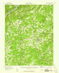
Appomattox, VA
Old map for history, not navigation
USGS historical 15-minute topo (1958)

Arringdale, VA
Old map for history, not navigation
USGS historical 15-minute topo (1920)

Arringdale, VA
Old map for history, not navigation
USGS historical 15-minute topo (1942)

Aylett, VA
Old map for history, not navigation
USGS historical 15-minute topo (1918)

Aylett, VA
Old map for history, not navigation
USGS historical 15-minute topo (1933)

Back Bay, VA
Old map for history, not navigation
USGS historical 15-minute topo (1916)

Back Bay, VA
Old map for history, not navigation
USGS historical 15-minute topo (1943)

Bermuda Hundred, VA
Old map for history, not navigation
USGS historical 15-minute topo (1894)

Bermuda Hundred, VA
Old map for history, not navigation
USGS historical 15-minute topo (1946)

Berryville, VA
Old map for history, not navigation
USGS historical 15-minute topo (1944)

Big Stone Gap, VA
Old map for history, not navigation
USGS historical 15-minute topo (1922)

Big Stone Gap, VA
Old map for history, not navigation
USGS historical 15-minute topo (1929)

Blacksburg, VA
Old map for history, not navigation
USGS historical 15-minute topo (1932)

Blacksburg, VA
Old map for history, not navigation
USGS historical 15-minute topo (1937)

Bland, VA
Old map for history, not navigation
USGS historical 15-minute topo (1956)

Boones Mill, VA
Old map for history, not navigation
USGS historical 15-minute topo (1951)

Boydton, VA
Old map for history, not navigation
USGS historical 15-minute topo (1955)

Boykins, VA
Old map for history, not navigation
USGS historical 15-minute topo (1920)

Broadwater, VA
Old map for history, not navigation
USGS historical 15-minute topo (1941)

Broadway, VA
Old map for history, not navigation
USGS historical 15-minute topo (1947)

Broadway, VA
Old map for history, not navigation
USGS historical 15-minute topo (1950)

Brookneal, VA
Old map for history, not navigation
USGS historical 15-minute topo (1956)

Buckingham, VA
Old map for history, not navigation
USGS historical 15-minute topo (1961)

Bucu, VA
Old map for history, not navigation
USGS historical 15-minute topo (1916)
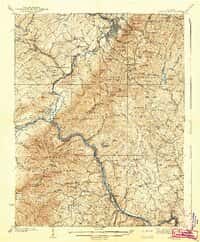
Buena Vista, VA
Old map for history, not navigation
USGS historical 15-minute topo (1939)

Buena Vista, VA
Old map for history, not navigation
USGS historical 15-minute topo (1940)
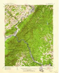
Buena Vista, VA
Old map for history, not navigation
USGS historical 15-minute topo (1950)
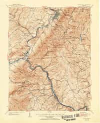
Buena Vista, VA
Old map for history, not navigation
USGS historical 15-minute topo (1952)

Burkes Garden, VA
Old map for history, not navigation
USGS historical 15-minute topo (1941)

Callaghan, VA
Old map for history, not navigation
USGS historical 15-minute topo (1923)

Callaghan, VA
Old map for history, not navigation
USGS historical 15-minute topo (1946)

Callaghan, VA
Old map for history, not navigation
USGS historical 15-minute topo (1949)

Callands, VA
Old map for history, not navigation
USGS historical 15-minute topo (1924)

Callands, VA
Old map for history, not navigation
USGS historical 15-minute topo (1944)

Cape Henry, VA
Old map for history, not navigation
USGS historical 15-minute topo (1918)

Cape Henry, VA
Old map for history, not navigation
USGS historical 15-minute topo (1919)

Carterton, VA
Old map for history, not navigation
USGS historical 15-minute topo (1918)

Catlett, VA
Old map for history, not navigation
USGS historical 15-minute topo (1943)

Charles City, VA
Old map for history, not navigation
USGS historical 15-minute topo (1918)

Charles City, VA
Old map for history, not navigation
USGS historical 15-minute topo (1953)

Charlotte Court House, VA
Old map for history, not navigation
USGS historical 15-minute topo (1956)

Charlottesville, VA
Old map for history, not navigation
USGS historical 15-minute topo (1935)
Every Virginia historical topo map by name
- Accomac, VA (1931)
- Accomac, VA (1935)
- Altavista, VA (1951)
- Amherst, VA (1939)
- Amherst, VA (1950)
- Amherst, VA (1952)
- Appomattox, VA (1958)
- Arringdale, VA (1920)
- Arringdale, VA (1942)
- Aylett, VA (1918)
- Aylett, VA (1933)
- Back Bay, VA (1916)
- Back Bay, VA (1943)
- Bermuda Hundred, VA (1894)
- Bermuda Hundred, VA (1946)
- Berryville, VA (1944)
- Big Stone Gap, VA (1922)
- Big Stone Gap, VA (1929)
- Blacksburg, VA (1932)
- Blacksburg, VA (1937)
- Bland, VA (1956)
- Boones Mill, VA (1951)
- Boydton, VA (1955)
- Boykins, VA (1920)
- Broadwater, VA (1941)
- Broadway, VA (1947)
- Broadway, VA (1950)
- Brookneal, VA (1956)
- Buckingham, VA (1961)
- Bucu, VA (1916)
- Buena Vista, VA (1939)
- Buena Vista, VA (1940)
- Buena Vista, VA (1950)
- Buena Vista, VA (1952)
- Burkes Garden, VA (1941)
- Callaghan, VA (1923)
- Callaghan, VA (1946)
- Callaghan, VA (1949)
- Callands, VA (1924)
- Callands, VA (1944)
- Cape Henry, VA (1918)
- Cape Henry, VA (1919)
- Carterton, VA (1918)
- Catlett, VA (1943)
- Charles City, VA (1918)
- Charles City, VA (1953)
- Charlotte Court House, VA (1956)
- Charlottesville, VA (1935)
- Charlottesville, VA (1939)
- Charlottesville, VA (1949)
- Chase City, VA (1955)
- Chatham, VA (1923)
- Clarksville, VA (1943)
- Clarksville, VA (1957)
- Clifton Forge, VA (1945)
- Clintwood, VA (1913)
- Clintwood, VA (1915)
- Clover, VA (1954)
- Coeburn, VA (1920)
- Columbia, VA (1960)
- Covesville, VA (1929)
- Covesville, VA (1935)
- Covesville, VA (1945)
- Craigsville, VA (1943)
- Craigsville, VA (1945)
- Crewe, VA (1958)
- Critz, VA (1926)
- Critz, VA (1928)
- Danville, VA (1925)
- Dillwyn, VA (1950)
- Dillwyn, VA (1958)
- Disputanta, VA (1919)
- Doswell, VA (1918)
- Draper, VA (1926)
- Draper, VA (1944)
- Eagle Rock, VA (1913)
- Eagle Rock, VA (1915)
- Edinburg, VA (1947)
- Edinburg, VA (1951)
- Elkton, VA (1937)
- Elliston, VA (1950)
- Emporia, VA (1919)
- Emporia, VA (1942)
- Endicott, VA (1957)
- Ewell, VA (1917)
- Fairfax, VA (1915)
- Fairfax, VA (1944)
- Farmville, VA (1958)
- Floyd, VA (1957)
- Front Royal, VA (1939)
- Front Royal, VA (1944)
- Galax, VA (1933)
- Gladys, VA (1956)
- Goode, VA (1950)
- Gordonsville, VA (1961)
- Hagan, VA (1932)
- Halifax, VA (1954)
- Hampton, VA (1907)
- Harrisonburg, VA (1941)
- Harrisonburg, VA (1943)
- Heathsville, VA (1917)
- Holland, VA (1920)
- Holland, VA (1943)
- Holland, VA (1957)
- Homeville, VA (1920)
- Hurley, VA (1915)
- Independence, VA (1933)
- Ivor, VA (1920)
- Jarratt, VA (1919)
- Jarratt, VA (1951)
- Jetersville, VA (1958)
- Kenbridge, VA (1955)
- Keysville, VA (1958)
- Kilmarnock, VA (1916)
- Kilmarnock, VA (1917)
- Kilmarnock, VA (1942)
- King William, VA (1920)
- Lake Drummond, VA (1940)
- Lake Drummond, VA (1945)
- Lakeside Village, VA (1960)
- Lawrenceville, VA (1918)
- Lawrenceville, VA (1921)
- Lawrenceville, VA (1942)
- Lexington, VA (1937)
- Lexington, VA (1950)
- Lexington, VA (1951)
- Lovingston, VA (1943)
- Lovingston, VA (1946)
- Lynchburg, VA (1944)
- Lynchburg, VA (1950)
- Macks Mountain, VA (1956)
- Madison, VA (1930)
- Madison, VA (1933)
- Martinsville, VA (1926)
- Martinsville, VA (1927)
- Martinsville, VA (1944)
- Mathews, VA (1916)
- Mathews, VA (1917)
- Max Meadows, VA (1930)
- Mc Dowell, VA (1924)
- Mc Dowell, VA (1944)
- Mc Dowell, VA (1946)
- Mc Kenney, VA (1921)
- Mc Kenney, VA (1943)
- Middleburg, VA (1933)
- Middletown, VA (1923)
- Middletown, VA (1937)
- Middletown, VA (1943)
- Millboro, VA (1946)
- Millboro, VA (1949)
- Milton, VA (1952)
- Milton, VA (1956)
- Moneta, VA (1951)
- Monterey, VA (1941)
- Monterey, VA (1944)
- Morattico, VA (1917)
- Morattico, VA (1918)
- Morattico, VA (1926)
- Mount Airy, VA (1957)
- Mount Rogers, VA (1939)
- Mouth of Wilson, VA (1940)
- Moyock, VA (1939)
- Moyock, VA (1946)
- Mt Jackson, VA (1942)
- Mt Jackson, VA (1946)
- Mt Jackson, VA (1947)
- Nanjemoy, VA (1944)
- Natural Bridge, VA (1894)
- Natural Bridge, VA (1907)
- New Castle, VA (1945)
- New Castle, VA (1947)
- New Kent, VA (1919)
- Newport News, VA (1921)
- Pamplin City, VA (1958)
- Parnassus, VA (1944)
- Parnassus, VA (1947)
- Peaks of Otter, VA (1950)
- Pearisburg, VA (1923)
- Pearisburg, VA (1932)
- Pearisburg, VA (1937)
- Petersburg, VA (1894)
- Petersburg, VA (1946)
- Pound, VA (1912)
- Pound, VA (1914)
- Pounding Mill, VA (1916)
- Pounding Mill, VA (1926)
- Pounding Mill, VA (1947)
- Pulaski, VA (1940)
- Quantico, VA (1927)
- Quantico, VA (1940)
- Quantico, VA (1943)
- Quantico, VA (1957)
- Radford, VA (1950)
- Rapidan, VA (1961)
- Regina, VA (1916)
- Riceville, VA (1954)
- Richlands, VA (1916)
- Richlands, VA (1950)
- Richmond, VA (1894)
- Richmond, VA (1895)
- Roanoke, VA (1929)
- Roanoke, VA (1933)
- Rocky Mount, VA (1927)
- Rocky Mount, VA (1944)
- Salem, VA (1929)
- Salem, VA (1932)
- Scottsville, VA (1943)
- Scottsville, VA (1946)
- Shipman, VA (1961)
- Smithfield, VA (1919)
- South Boston, VA (1953)
- South Boston, VA (1957)
- Speedwell, VA (1930)
- Speedwell, VA (1939)
- Sperryville, VA (1961)
- Stafford, VA (1926)
- Stafford, VA (1931)
- Staunton, VA (1944)
- Staunton, VA (1947)
- Stony Man, VA (1929)
- Stony Man, VA (1933)
- Strasburg, VA (1947)
- Strasburg, VA (1950)
- Stuart, VA (1928)
- Stuart, VA (1931)
- Suffolk, VA (1919)
- Suffolk, VA (1954)
- Surry, VA (1919)
- Tappahannock, VA (1918)
- Tappahannock, VA (1919)
- Toano, VA (1917)
- Toano, VA (1918)
- University, VA (1931)
- University, VA (1935)
- Urbanna, VA (1917)
- Vesuvius, VA (1941)
- Vesuvius, VA (1950)
- Vesuvius, VA (1951)
- Waiteville, VA (1923)
- Waiteville, VA (1944)
- Waiteville, VA (1951)
- Wakefield, VA (1932)
- Warm Springs, VA (1926)
- Warm Springs, VA (1946)
- Warm Springs, VA (1949)
- Warrenton, VA (1894)
- Warrenton, VA (1927)
- Warrenton, VA (1930)
- Waynesboro, VA (1934)
- Waynesboro, VA (1939)
- White Plains, VA (1920)
- Williamsburg, VA (1906)
- Williamsville, VA (1946)
- Williamsville, VA (1949)
- Winchester, VA (1942)
- Wise, VA (1921)
- Yorktown, VA (1907)
- Yorktown, VA (1943)