Utah BLM maps
Cartahaven has 28 BLM maps of Utah, all free. Recreation maps from the Bureau of Land Management: public land, roads, trails and recreation sites.
Download one to your phone and the map app shows your GPS position on it with no cell signal.

Amasa Basin
BLM Utah

Burbank Hills
BLM Utah

Conger Mountain
BLM Utah

Crack Canyon Wilderness Study Area
BLM Utah

Cricket Mountains
BLM Utah

Deep Creek Mountains Wilderness Study Area
BLM Utah (2021)

E-Bike Opportunities
BLM Utah (2024)

Fantasy Canyon
BLM Utah (2024)

Gemini Bridges Designated Routes
BLM Utah

Kanab Community Non-Motorized Trails
BLM Utah

Lake Mountains
BLM Utah

Little Sahara
BLM Utah

Mill Canyon Designated Routes
BLM Utah (2024)

Moab Camping
BLM Utah

Moab Visitor Map
North — BLM Utah (2021)

Moab Visitor Map
South — BLM Utah (2021)

Moonshine Arch
BLM Utah

Pahvant Valley Heritage Trail
BLM Utah

Piute County
BLM Utah

Pony Express National Backcountry Byway
BLM Utah

Red Mountain Wilderness Area
BLM Utah

Sand Mountain Open OHV Area
BLM Utah

Sanpete County
BLM Utah

Sevier County
BLM Utah

Temple Mountain Recreation Area
BLM Utah

Transcontinental Railroad
BLM Utah

Westwater River Recreation
BLM Utah (2021)
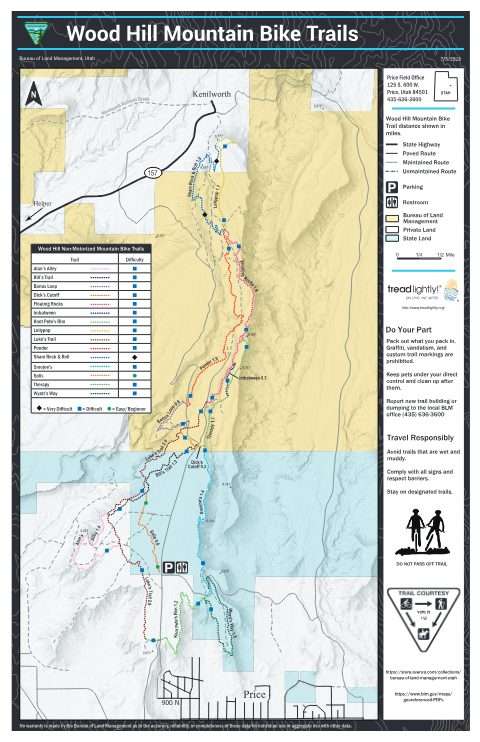
Wood Hill Trails
BLM Utah (2023)