Texas historical topo maps
Cartahaven has 564 historical topo maps of Texas, all free. These are the USGS 15-minute (1:62,500) quadrangles from the mid-1900s: old roads, mines, homesteads, rail lines and place names that newer maps leave off.
Download one to your phone and the map app shows your GPS position on it with no cell signal.
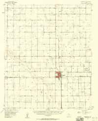
Abernathy, TX
Old map for history, not navigation
USGS historical 15-minute topo (1957)

Addicks, TX
Old map for history, not navigation
USGS historical 15-minute topo (1955)

Ady, TX
Old map for history, not navigation
USGS historical 15-minute topo (1934)

Ady, TX
Old map for history, not navigation
USGS historical 15-minute topo (1936)

Agua Fria, TX
Old map for history, not navigation
USGS historical 15-minute topo (1917)

Agua Fria, TX
Old map for history, not navigation
USGS historical 15-minute topo (1937)

Agua Nueva, TX
Old map for history, not navigation
USGS historical 15-minute topo (1938)

Aguilares, TX
Old map for history, not navigation
USGS historical 15-minute topo (1940)

Aguilete Creek, TX
Old map for history, not navigation
USGS historical 15-minute topo (1937)

Alba, TX
Old map for history, not navigation
USGS historical 15-minute topo (1959)

Algerita, TX
Old map for history, not navigation
USGS historical 15-minute topo (1956)

Alto, TX
Old map for history, not navigation
USGS historical 15-minute topo (1946)

Altuda, TX
Old map for history, not navigation
USGS historical 15-minute topo (1923)

Anton, TX
Old map for history, not navigation
USGS historical 15-minute topo (1957)

Aransas Pass, TX
Old map for history, not navigation
USGS historical 15-minute topo (1925)

Aransas Pass, TX
Old map for history, not navigation
USGS historical 15-minute topo (1954)

Archer City, TX
Old map for history, not navigation
USGS historical 15-minute topo (1931)

Arlington, TX
Old map for history, not navigation
USGS historical 15-minute topo (1959)

Armstrong, TX
Old map for history, not navigation
USGS historical 15-minute topo (1923)

Armstrong, TX
Old map for history, not navigation
USGS historical 15-minute topo (1956)

Arroyo Clareno, TX
Old map for history, not navigation
USGS historical 15-minute topo (1956)

Artesia Wells, TX
Old map for history, not navigation
USGS historical 15-minute topo (1940)
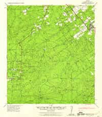
Asherton, TX
Old map for history, not navigation
USGS historical 15-minute topo (1940)

Aspermont, TX
Old map for history, not navigation
USGS historical 15-minute topo (1931)

Athens, TX
Old map for history, not navigation
USGS historical 15-minute topo (1949)

Athens, TX
Old map for history, not navigation
USGS historical 15-minute topo (1950)

Atlanta, TX
Old map for history, not navigation
USGS historical 15-minute topo (1907)

Atlanta, TX
Old map for history, not navigation
USGS historical 15-minute topo (1910)

Austin, TX
Old map for history, not navigation
USGS historical 15-minute topo (1955)

Baker Crossing, TX
Old map for history, not navigation
USGS historical 15-minute topo (1944)

Bandera, TX
Old map for history, not navigation
USGS historical 15-minute topo (1956)

Barksdale, TX
Old map for history, not navigation
USGS historical 15-minute topo (1944)

Barksdale, TX
Old map for history, not navigation
USGS historical 15-minute topo (1975)

Barnhart, TX
Old map for history, not navigation
USGS historical 15-minute topo (1920)

Barnhart, TX
Old map for history, not navigation
USGS historical 15-minute topo (1922)

Bart, TX
Old map for history, not navigation
USGS historical 15-minute topo (1927)

Bassett, TX
Old map for history, not navigation
USGS historical 15-minute topo (1930)

Bastrop, TX
Old map for history, not navigation
USGS historical 15-minute topo (1948)

Bastrop, TX
Old map for history, not navigation
USGS historical 15-minute topo (1950)

Batesville, TX
Old map for history, not navigation
USGS historical 15-minute topo (1957)

Beaumont, TX
Old map for history, not navigation
USGS historical 15-minute topo (1932)

Becerra Creek, TX
Old map for history, not navigation
USGS historical 15-minute topo (1933)

Becerra, TX
Old map for history, not navigation
USGS historical 15-minute topo (1956)

Bellville, TX
Old map for history, not navigation
USGS historical 15-minute topo (1956)

Belton, TX
Old map for history, not navigation
USGS historical 15-minute topo (1931)

Ben Bolt, TX
Old map for history, not navigation
USGS historical 15-minute topo (1917)

Benavides, TX
Old map for history, not navigation
USGS historical 15-minute topo (1956)

Bend, TX
Old map for history, not navigation
USGS historical 15-minute topo (1931)