Oregon national forest maps
Cartahaven has 75 national forest maps of Oregon, all free. Forest visitor maps, motor vehicle use maps and winter travel maps from the USDA Forest Service: which roads and trails are open, to what, and when.
Download one to your phone and the map app shows your GPS position on it with no cell signal.

Barlow & Hood River Ranger Districts Motor Vehicle Use Map (MVUM)
Forest roads and trails open to vehicles
Mt. Hood National Forest

Bend Area Snowmobile Trails
Deschutes National Forest (2019)

Clackamas River Ranger District Motor Vehicle Use Map (MVUM)
Forest roads and trails open to vehicles
Mt. Hood National Forest (2025)
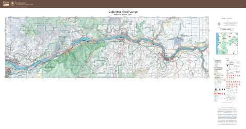
Columbia River Gorge National Scenic Area
Forest Service forest map

Cottage Grove Ranger District Motor Vehicle Use Map (MVUM)
Forest roads and trails open to vehicles
Umpqua National Forest (2024)

Crooked River National Grassland, Ochoco National Forest
Forest Service forest map

Deschutes Motor Vehicle Use Map 1
Forest roads and trails open to vehicles
Deschutes National Forest

Deschutes Motor Vehicle Use Map 2
Forest roads and trails open to vehicles
Deschutes National Forest

Deschutes Motor Vehicle Use Map 3
Forest roads and trails open to vehicles
Deschutes National Forest

Deschutes Motor Vehicle Use Map 4
Forest roads and trails open to vehicles
Deschutes National Forest

Deschutes Motor Vehicle Use Map 5
Forest roads and trails open to vehicles
Deschutes National Forest

Deschutes Motor Vehicle Use Map 6
Forest roads and trails open to vehicles
Deschutes National Forest

Deschutes Motor Vehicle Use Map 7
Forest roads and trails open to vehicles
Deschutes National Forest

Deschutes Motor Vehicle Use Map 8
Forest roads and trails open to vehicles
Deschutes National Forest

Deschutes Motor Vehicle Use Map 9
Forest roads and trails open to vehicles
Deschutes National Forest

Deschutes National Forest
Forest Service forest map

Detroit Ranger District Motor Vehicle Use Map (MVUM)
Forest roads and trails open to vehicles
Willamette National Forest (2025)

Diamond Lake Ranger District
Forest roads and trails open to vehicles
East Motor Vehicle Use Map (MVUM) — Umpqua National Forest (2024)

Diamond Lake Ranger District
Forest roads and trails open to vehicles
West Motor Vehicle Use Map (MVUM) — Umpqua National Forest (2024)

Dutchman Sno-Park Ski Trail Map
Deschutes National Forest (2023)

Edison Sno-Park Nordic Trails Map
Deschutes National Forest (2023)

Entire District Motor Vehicle Use Map (MVUM)
Forest roads and trails open to vehicles
Umatilla National Forest (2026)

Fremont-Winema National Forest
Forest Service forest map

Malheur National Forest
Forest Service forest map

Map 1 Motor Vehicle Use Map (MVUM)
Forest roads and trails open to vehicles
Umatilla National Forest (2026)

Map 10 Motor Vehicle Use Map (MVUM)
Forest roads and trails open to vehicles
Umatilla National Forest (2026)

Map 11 Motor Vehicle Use Map (MVUM)
Forest roads and trails open to vehicles
Umatilla National Forest (2026)

Map 12 Motor Vehicle Use Map (MVUM)
Forest roads and trails open to vehicles
Umatilla National Forest (2026)

Map 13 Motor Vehicle Use Map (MVUM)
Forest roads and trails open to vehicles
Umatilla National Forest (2026)

Map 14 Motor Vehicle Use Map (MVUM)
Forest roads and trails open to vehicles
Umatilla National Forest (2026)

Map 15 Motor Vehicle Use Map (MVUM)
Forest roads and trails open to vehicles
Umatilla National Forest (2026)

Map 17 Motor Vehicle Use Map (MVUM)
Forest roads and trails open to vehicles
Umatilla National Forest (2026)

Map 2 Motor Vehicle Use Map (MVUM)
Forest roads and trails open to vehicles
Umatilla National Forest (2026)

Map 3 Motor Vehicle Use Map (MVUM)
Forest roads and trails open to vehicles
Umatilla National Forest (2026)

Map 4 Motor Vehicle Use Map (MVUM)
Forest roads and trails open to vehicles
Umatilla National Forest (2026)

Map 5 Motor Vehicle Use Map (MVUM)
Forest roads and trails open to vehicles
Umatilla National Forest (2026)

Map 6 Motor Vehicle Use Map (MVUM)
Forest roads and trails open to vehicles
Umatilla National Forest (2026)

Map 7 Motor Vehicle Use Map (MVUM)
Forest roads and trails open to vehicles
Umatilla National Forest (2026)

Map 8 Motor Vehicle Use Map (MVUM)
Forest roads and trails open to vehicles
Umatilla National Forest (2026)

Map 9 Motor Vehicle Use Map (MVUM)
Forest roads and trails open to vehicles
Umatilla National Forest (2026)

McKenzie River Ranger District
Forest roads and trails open to vehicles
North Motor Vehicle Use Map (MVUM) — Willamette National Forest (2025)

McKenzie River Ranger District
Forest roads and trails open to vehicles
South Motor Vehicle Use Map (MVUM) — Willamette National Forest (2025)

Meissner Sno-Park Nordic Trails Map
Deschutes National Forest (2021)

Middle Fork Ranger District
Forest roads and trails open to vehicles
North (front and back) Motor Vehicle Use Map (MVUM) — Willamette National Forest (2025)

Middle Fork Ranger District
Forest roads and trails open to vehicles
South (front and back) Motor Vehicle Use Map (MVUM) — Willamette National Forest (2025)

Mt. Hood National Forest
Forest Service forest map

Motor Vehicle Use Map (MVUM)
Forest roads and trails open to vehicles
Rogue River-Siskiyou National Forest (2019)

Newberry (10 Mile Sno-Park area) Snowmobile Map
Deschutes National Forest (2015)

North Central Coast Ranger District Motor Vehicle Use Map (MVUM)
Forest roads and trails open to vehicles
Siuslaw National Forest (2026)

North Umpqua Ranger District
Forest roads and trails open to vehicles
North Motor Vehicle Use Map (MVUM) — Umpqua National Forest (2024)

North Umpqua Ranger District
Forest roads and trails open to vehicles
South Motor Vehicle Use Map (MVUM) — Umpqua National Forest (2024)

Ochoco National Forest
Forest Service forest map

Ochoco National Forest Motor Vehicle Use Map (MVUM)
Forest roads and trails open to vehicles
Map 1 (2026)

Ochoco National Forest Motor Vehicle Use Map (MVUM)
Forest roads and trails open to vehicles
Map 2 (2026)

Ochoco National Forest Motor Vehicle Use Map (MVUM)
Forest roads and trails open to vehicles
Map 3 (2026)

Ochoco National Forest Motor Vehicle Use Map (MVUM)
Forest roads and trails open to vehicles
Map 4 (2026)

Rogue River-Siskiyou National Forests
Forest Service forest map

Santiam Pass Winter Snowmobile Map
Deschutes National Forest

Siuslaw National Forest
Forest Service forest map

Skyliner Sno-Park Nordic Trails Map
Deschutes National Forest (2019)

South Central Coast Ranger District Motor Vehicle Use Map (MVUM)
Forest roads and trails open to vehicles
Siuslaw National Forest (2026)

Swampy Sno-Park Nordic Trails Map
Deschutes National Forest

Sweet Home Ranger District Motor Vehicle Use Map (MVUM)
Forest roads and trails open to vehicles
Willamette National Forest (2025)

Three Creek Nordic Trails Map
Deschutes National Forest (2022)

Tiller Ranger District
Forest roads and trails open to vehicles
East Motor Vehicle Use Map (MVUM) — Umpqua National Forest (2024)

Tiller Ranger District
Forest roads and trails open to vehicles
West Motor Vehicle Use Map (MVUM) — Umpqua National Forest (2024)

Umatilla National Forest
East — Forest Service forest map

Umatilla National Forest
West — Forest Service forest map

Umpqua National Forest
Forest Service forest map

Vista Butte Sno-Park Nordic Trails Map
Deschutes National Forest

Wallowa-Whitman National Forest
Forest Service forest map

Wallowa-Whitman National Forest Snowmobile Map (2023)
Forest Service Maps
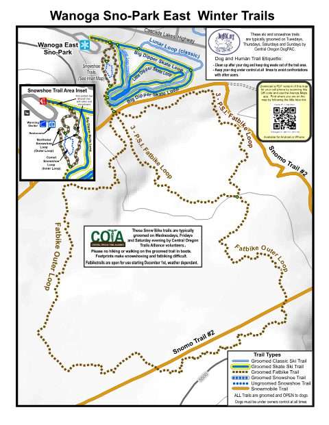
Wanoga Sno-Park East
Deschutes National Forest (2018)

Willamette National Forest
Forest Service forest map

Zigzag Ranger District Motor Vehicle Use Map (MVUM)
Forest roads and trails open to vehicles
Mt. Hood National Forest (2025)