North Carolina historical topo maps
Cartahaven has 129 historical topo maps of North Carolina, all free. These are the USGS 15-minute (1:62,500) quadrangles from the mid-1900s: old roads, mines, homesteads, rail lines and place names that newer maps leave off.
Download one to your phone and the map app shows your GPS position on it with no cell signal.

Acme, NC
Old map for history, not navigation
USGS historical 15-minute topo (1954)

Albemarle, NC
Old map for history, not navigation
USGS historical 15-minute topo (1957)

Asheboro, NC
Old map for history, not navigation
USGS historical 15-minute topo (1957)

Atkinson, NC
Old map for history, not navigation
USGS historical 15-minute topo (1955)

Ayden, NC
Old map for history, not navigation
USGS historical 15-minute topo (1902)

Ayden, NC
Old map for history, not navigation
USGS historical 15-minute topo (1904)

Barco, NC
Old map for history, not navigation
USGS historical 15-minute topo (1940)

Beckford, NC
Old map for history, not navigation
USGS historical 15-minute topo (1907)

Beckford, NC
Old map for history, not navigation
USGS historical 15-minute topo (1940)
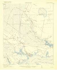
Belhaven, NC
Old map for history, not navigation
USGS historical 15-minute topo (1916)

Bladenboro, NC
Old map for history, not navigation
USGS historical 15-minute topo (1957)

Blowing Rock, NC
Old map for history, not navigation
USGS historical 15-minute topo (1942)

Bolton, NC
Old map for history, not navigation
USGS historical 15-minute topo (1954)

Bryson, NC
Old map for history, not navigation
USGS historical 15-minute topo (1933)

Burgaw, NC
Old map for history, not navigation
USGS historical 15-minute topo (1942)

Bushnell, NC
Old map for history, not navigation
USGS historical 15-minute topo (1933)

Chadbourn, NC
Old map for history, not navigation
USGS historical 15-minute topo (1953)

Charlotte, NC
Old map for history, not navigation
USGS historical 15-minute topo (1905)

Charlotte, NC
Old map for history, not navigation
USGS historical 15-minute topo (1907)

Chocowinity, NC
Old map for history, not navigation
USGS historical 15-minute topo (1903)

Chocowinity, NC
Old map for history, not navigation
USGS historical 15-minute topo (1905)

Clifdale, NC
Old map for history, not navigation
USGS historical 15-minute topo (1948)

Clifdale, NC
Old map for history, not navigation
USGS historical 15-minute topo (1951)

Coharie, NC
Old map for history, not navigation
USGS historical 15-minute topo (1909)

Creedmoor, NC
Old map for history, not navigation
USGS historical 15-minute topo (1943)

Creedmoor, NC
Old map for history, not navigation
USGS historical 15-minute topo (1944)

Deep Run, NC
Old map for history, not navigation
USGS historical 15-minute topo (1958)

Denton, NC
Old map for history, not navigation
USGS historical 15-minute topo (1957)

Durham North, NC
Old map for history, not navigation
USGS historical 15-minute topo (1951)

Durham South, NC
Old map for history, not navigation
USGS historical 15-minute topo (1943)

Durham South, NC
Old map for history, not navigation
USGS historical 15-minute topo (1951)

Edenton, NC
Old map for history, not navigation
USGS historical 15-minute topo (1904)

Edenton, NC
Old map for history, not navigation
USGS historical 15-minute topo (1942)

Edenton, NC
Old map for history, not navigation
USGS historical 15-minute topo (1943)

Elizabeth City, NC
Old map for history, not navigation
USGS historical 15-minute topo (1948)

Elizabethtown, NC
Old map for history, not navigation
USGS historical 15-minute topo (1955)

Fair Bluff, NC
Old map for history, not navigation
USGS historical 15-minute topo (1962)

Falkland, NC
Old map for history, not navigation
USGS historical 15-minute topo (1904)

Fayetteville, NC
Old map for history, not navigation
USGS historical 15-minute topo (1948)

Fayetteville, NC
Old map for history, not navigation
USGS historical 15-minute topo (1957)

Four Oaks, NC
Old map for history, not navigation
USGS historical 15-minute topo (1908)

Fowler Bend, NC
Old map for history, not navigation
USGS historical 15-minute topo (1938)

Garland, NC
Old map for history, not navigation
USGS historical 15-minute topo (1959)

Garner, NC
Old map for history, not navigation
USGS historical 15-minute topo (1964)

Gastonia, NC
Old map for history, not navigation
USGS historical 15-minute topo (1914)

Gastonia, NC
Old map for history, not navigation
USGS historical 15-minute topo (1916)

Goldsboro, NC
Old map for history, not navigation
USGS historical 15-minute topo (1957)

Hamlet, NC
Old map for history, not navigation
USGS historical 15-minute topo (1949)
Every North Carolina historical topo map by name
- Acme, NC (1954)
- Albemarle, NC (1957)
- Asheboro, NC (1957)
- Atkinson, NC (1955)
- Ayden, NC (1902)
- Ayden, NC (1904)
- Barco, NC (1940)
- Beckford, NC (1907)
- Beckford, NC (1940)
- Belhaven, NC (1916)
- Bladenboro, NC (1957)
- Blowing Rock, NC (1942)
- Bolton, NC (1954)
- Bryson, NC (1933)
- Burgaw, NC (1942)
- Bushnell, NC (1933)
- Chadbourn, NC (1953)
- Charlotte, NC (1905)
- Charlotte, NC (1907)
- Chocowinity, NC (1903)
- Chocowinity, NC (1905)
- Clifdale, NC (1948)
- Clifdale, NC (1951)
- Coharie, NC (1909)
- Creedmoor, NC (1943)
- Creedmoor, NC (1944)
- Deep Run, NC (1958)
- Denton, NC (1957)
- Durham North, NC (1951)
- Durham South, NC (1943)
- Durham South, NC (1951)
- Edenton, NC (1904)
- Edenton, NC (1942)
- Edenton, NC (1943)
- Elizabeth City, NC (1948)
- Elizabethtown, NC (1955)
- Fair Bluff, NC (1962)
- Falkland, NC (1904)
- Fayetteville, NC (1948)
- Fayetteville, NC (1957)
- Four Oaks, NC (1908)
- Fowler Bend, NC (1938)
- Garland, NC (1959)
- Garner, NC (1964)
- Gastonia, NC (1914)
- Gastonia, NC (1916)
- Goldsboro, NC (1957)
- Hamlet, NC (1949)
- Hertford, NC (1906)
- Hertford, NC (1940)
- Jackson Springs, NC (1949)
- Jackson Springs, NC (1957)
- Jacksonville, NC (1943)
- Kenansville, NC (1943)
- Kenansville, NC (1948)
- Kenly, NC (1902)
- Kenly, NC (1903)
- Kinston, NC (1914)
- Kinston, NC (1916)
- Kitty Hawk, NC (1940)
- Lake Lure, NC (1959)
- Laurinburg, NC (1949)
- Lenoir, NC (1956)
- Lincolnton, NC (1909)
- Lincolnton, NC (1911)
- Linville Falls, NC (1956)
- Linville, NC (1944)
- Maple Hill, NC (1948)
- Marion, NC (1962)
- Maysville, NC (1942)
- Maysville, NC (1948)
- Mount Pleasant, NC (1957)
- New Bern, NC (1901)
- New Bern, NC (1903)
- New River, NC (1948)
- Oxford, NC (1953)
- Oxford, NC (1966)
- Pages Mill, NC (1943)
- Parmele, NC (1901)
- Parmele, NC (1902)
- Powells Point, NC (1940)
- Raleigh, NC (1943)
- Raleigh, NC (1951)
- Richlands, NC (1948)
- Richlands, NC (1965)
- Richlands, NC (1980)
- Rocky Mount, NC (1902)
- Rocky Mount, NC (1904)
- Rocky Point, NC (1947)
- Rose Hill, NC (1962)
- Roseboro, NC (1959)
- Roxboro, NC (1943)
- Saint Pauls, NC (1959)
- Selma, NC (1964)
- Seven Springs, NC (1957)
- Shelby, NC (1950)
- South Mills, NC (1940)
- South Mills, NC (1952)
- Southern Pines, NC (1948)
- Southern Pines, NC (1957)
- Spicer Bay, NC (1942)
- Spring Hope, NC (1902)
- Springhope, NC (1904)
- Swansboro, NC (1942)
- Swansboro, NC (1948)
- Tarboro, NC (1902)
- Tarboro, NC (1903)
- Topsail, NC (1942)
- Topsail, NC (1948)
- Trent River, NC (1903)
- Trent River, NC (1904)
- Troy, NC (1957)
- Vanceboro, NC (1902)
- Vanceboro, NC (1904)
- Vanceboro, NC (1905)
- Wade Point, NC (1940)
- Wade Point, NC (1943)
- Wade Point, NC (1948)
- Wayah Bald, NC (1942)
- White Lake, NC (1954)
- Whiteville, NC (1955)
- Williamston, NC (1901)
- Williamston, NC (1902)
- Wilmington, NC (1942)
- Wilmington, NC (1948)
- Wilson, NC (1904)
- Winterville, NC (1903)
- Winterville, NC (1905)
- Winton, NC (1908)