New Jersey historical topo maps
Cartahaven has 156 historical topo maps of New Jersey, all free. These are the USGS 15-minute (1:62,500) quadrangles from the mid-1900s: old roads, mines, homesteads, rail lines and place names that newer maps leave off.
Download one to your phone and the map app shows your GPS position on it with no cell signal.

Asbury Park, NJ
Old map for history, not navigation
USGS historical 15-minute topo (1888)

Asbury Park, NJ
Old map for history, not navigation
USGS historical 15-minute topo (1893)

Asbury Park, NJ
Old map for history, not navigation
USGS historical 15-minute topo (1901)

Asbury Park, NJ
Old map for history, not navigation
USGS historical 15-minute topo (1919)
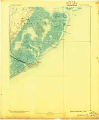
Atlantic City, NJ
Old map for history, not navigation
USGS historical 15-minute topo (1887)
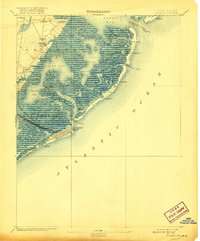
Atlantic City, NJ
Old map for history, not navigation
USGS historical 15-minute topo (1894)

Atlantic City, NJ
Old map for history, not navigation
USGS historical 15-minute topo (1940)

Atlantic City, NJ
Old map for history, not navigation
USGS historical 15-minute topo (1941)

Barnegat, NJ
Old map for history, not navigation
USGS historical 15-minute topo (1888)

Barnegat, NJ
Old map for history, not navigation
USGS historical 15-minute topo (1893)

Barnegat, NJ
Old map for history, not navigation
USGS historical 15-minute topo (1898)

Barnegat, NJ
Old map for history, not navigation
USGS historical 15-minute topo (1919)

Bay Side, NJ
Old map for history, not navigation
USGS historical 15-minute topo (1890)

Bay Side, NJ
Old map for history, not navigation
USGS historical 15-minute topo (1894)

Bay Side, NJ
Old map for history, not navigation
USGS historical 15-minute topo (1931)

Bordentown, NJ
Old map for history, not navigation
USGS historical 15-minute topo (1888)

Bordentown, NJ
Old map for history, not navigation
USGS historical 15-minute topo (1893)

Bordentown, NJ
Old map for history, not navigation
USGS historical 15-minute topo (1906)

Bordentown, NJ
Old map for history, not navigation
USGS historical 15-minute topo (1948)

Bridgeton, NJ
Old map for history, not navigation
USGS historical 15-minute topo (1890)

Bridgeton, NJ
Old map for history, not navigation
USGS historical 15-minute topo (1894)

Bridgeton, NJ
Old map for history, not navigation
USGS historical 15-minute topo (1942)

Bridgeton, NJ
Old map for history, not navigation
USGS historical 15-minute topo (1948)

Camp Dix, NJ
Old map for history, not navigation
USGS historical 15-minute topo (1918)

Cape May, NJ
Old map for history, not navigation
USGS historical 15-minute topo (1888)

Cape May, NJ
Old map for history, not navigation
USGS historical 15-minute topo (1893)

Cape May, NJ
Old map for history, not navigation
USGS historical 15-minute topo (1898)

Cape May, NJ
Old map for history, not navigation
USGS historical 15-minute topo (1918)

Cape May, NJ
Old map for history, not navigation
USGS historical 15-minute topo (1925)

Cape May, NJ
Old map for history, not navigation
USGS historical 15-minute topo (1940)

Cape May, NJ
Old map for history, not navigation
USGS historical 15-minute topo (1941)

Cassville, NJ
Old map for history, not navigation
USGS historical 15-minute topo (1888)

Cassville, NJ
Old map for history, not navigation
USGS historical 15-minute topo (1894)

Cassville, NJ
Old map for history, not navigation
USGS historical 15-minute topo (1900)

Dennisville, NJ
Old map for history, not navigation
USGS historical 15-minute topo (1888)

Dennisville, NJ
Old map for history, not navigation
USGS historical 15-minute topo (1894)

Dennisville, NJ
Old map for history, not navigation
USGS historical 15-minute topo (1919)

Dennisville, NJ
Old map for history, not navigation
USGS historical 15-minute topo (1941)

Dingmans Ferry, NJ
Old map for history, not navigation
USGS historical 15-minute topo (1954)

Egg Harbor, NJ
Old map for history, not navigation
USGS historical 15-minute topo (1942)

Franklin Furnace, NJ
Old map for history, not navigation
USGS historical 15-minute topo (1903)

Franklin, NJ
Old map for history, not navigation
USGS historical 15-minute topo (1888)

Franklin, NJ
Old map for history, not navigation
USGS historical 15-minute topo (1894)

Franklin, NJ
Old map for history, not navigation
USGS historical 15-minute topo (1897)
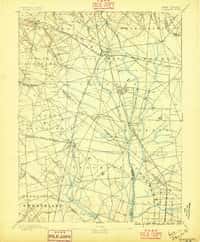
Glassboro, NJ
Old map for history, not navigation
USGS historical 15-minute topo (1890)

Glassboro, NJ
Old map for history, not navigation
USGS historical 15-minute topo (1898)
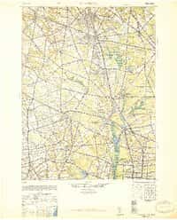
Glassboro, NJ
Old map for history, not navigation
USGS historical 15-minute topo (1948)

Great Egg Harbor, NJ
Old map for history, not navigation
USGS historical 15-minute topo (1890)
Every New Jersey historical topo map by name
- Asbury Park, NJ (1888)
- Asbury Park, NJ (1893)
- Asbury Park, NJ (1901)
- Asbury Park, NJ (1919)
- Atlantic City, NJ (1887)
- Atlantic City, NJ (1894)
- Atlantic City, NJ (1940)
- Atlantic City, NJ (1941)
- Barnegat, NJ (1888)
- Barnegat, NJ (1893)
- Barnegat, NJ (1898)
- Barnegat, NJ (1919)
- Bay Side, NJ (1890)
- Bay Side, NJ (1894)
- Bay Side, NJ (1931)
- Bordentown, NJ (1888)
- Bordentown, NJ (1893)
- Bordentown, NJ (1906)
- Bordentown, NJ (1948)
- Bridgeton, NJ (1890)
- Bridgeton, NJ (1894)
- Bridgeton, NJ (1942)
- Bridgeton, NJ (1948)
- Camp Dix, NJ (1918)
- Cape May, NJ (1888)
- Cape May, NJ (1893)
- Cape May, NJ (1898)
- Cape May, NJ (1918)
- Cape May, NJ (1925)
- Cape May, NJ (1940)
- Cape May, NJ (1941)
- Cassville, NJ (1888)
- Cassville, NJ (1894)
- Cassville, NJ (1900)
- Dennisville, NJ (1888)
- Dennisville, NJ (1894)
- Dennisville, NJ (1919)
- Dennisville, NJ (1941)
- Dingmans Ferry, NJ (1954)
- Egg Harbor, NJ (1942)
- Franklin Furnace, NJ (1903)
- Franklin, NJ (1888)
- Franklin, NJ (1894)
- Franklin, NJ (1897)
- Glassboro, NJ (1890)
- Glassboro, NJ (1898)
- Glassboro, NJ (1948)
- Great Egg Harbor, NJ (1890)
- Great Egg Harbor, NJ (1893)
- Great Egg Harbor, NJ (1918)
- Greenwood Lake, NJ (1910)
- Hackettstown, NJ (1888)
- Hackettstown, NJ (1894)
- Hackettstown, NJ (1898)
- Hackettstown, NJ (1905)
- Hammonton, NJ (1890)
- Hammonton, NJ (1894)
- Hammonton, NJ (1898)
- Hammonton, NJ (1919)
- Hammonton, NJ (1942)
- Hammonton, NJ (1948)
- Harlem, NJ (1891)
- High Bridge, NJ (1890)
- High Bridge, NJ (1898)
- High Bridge, NJ (1905)
- Lake Hopatcong, NJ (1888)
- Lake Hopatcong, NJ (1894)
- Lake Hopatcong, NJ (1898)
- Lake Hopatcong, NJ (1905)
- Lakehurst, NJ (1948)
- Lambertville, NJ (1890)
- Lambertville, NJ (1891)
- Lambertville, NJ (1894)
- Lambertville, NJ (1906)
- Little Egg Harbor, NJ (1888)
- Little Egg Harbor, NJ (1893)
- Little Egg Harbor, NJ (1920)
- Long Beach, NJ (1888)
- Long Beach, NJ (1893)
- Long Beach, NJ (1919)
- Long Beach, NJ (1941)
- Long Beach, NJ (1948)
- Maurice Cove, NJ (1890)
- Maurice Cove, NJ (1891)
- Morristown, NJ (1888)
- Morristown, NJ (1894)
- Morristown, NJ (1898)
- Morristown, NJ (1906)
- Mount Holly, NJ (1888)
- Mount Holly, NJ (1894)
- Mount Holly, NJ (1898)
- Mount Holly, NJ (1919)
- Mount Holly, NJ (1942)
- Mullica, NJ (1890)
- Mullica, NJ (1894)
- Mullica, NJ (1898)
- Mullica, NJ (1919)
- New Brunswick, NJ (1888)
- New Brunswick, NJ (1893)
- New Brunswick, NJ (1901)
- New Brunswick, NJ (1919)
- Paterson, NJ (1888)
- Paterson, NJ (1892)
- Paterson, NJ (1898)
- Paterson, NJ (1900)
- Paterson, NJ (1903)
- Pemberton, NJ (1888)
- Pemberton, NJ (1894)
- Pemberton, NJ (1898)
- Pemberton, NJ (1942)
- Pemberton, NJ (1949)
- Plainfield, NJ (1888)
- Plainfield, NJ (1893)
- Plainfield, NJ (1898)
- Plainfield, NJ (1905)
- Plainfield, NJ (1921)
- Pleasantville, NJ (1942)
- Pleasantville, NJ (1943)
- Pleasantville, NJ (1948)
- Port Norris, NJ (1941)
- Princeton, NJ (1888)
- Princeton, NJ (1894)
- Princeton, NJ (1906)
- Ramapo, NJ (1891)
- Ramapo, NJ (1893)
- Salem, NJ (1890)
- Salem, NJ (1898)
- Salem, NJ (1941)
- Salem, NJ (1948)
- Sandy Hook, NJ (1888)
- Sandy Hook, NJ (1893)
- Sandy Hook, NJ (1901)
- Sandy Hook, NJ (1918)
- Sea Isle City, NJ (1941)
- Sea Isle, NJ (1884)
- Sea Isle, NJ (1888)
- Sea Isle, NJ (1894)
- Sea Isle, NJ (1919)
- Shiloh, NJ (1941)
- Somerville, NJ (1891)
- Somerville, NJ (1893)
- Somerville, NJ (1898)
- Somerville, NJ (1905)
- Staten Island, NJ (1898)
- Staten Island, NJ (1900)
- Toms River, NJ (1941)
- Toms River, NJ (1948)
- Tuckahoe, NJ (1890)
- Tuckahoe, NJ (1893)
- Tuckahoe, NJ (1918)
- Tuckahoe, NJ (1941)
- Tuckerton, NJ (1942)
- Whiting, NJ (1888)
- Whiting, NJ (1942)
- Whiting, NJ (1949)
- Whitings, NJ (1884)