Nebraska historical topo maps
Cartahaven has 116 historical topo maps of Nebraska, all free. These are the USGS 15-minute (1:62,500) quadrangles from the mid-1900s: old roads, mines, homesteads, rail lines and place names that newer maps leave off.
Download one to your phone and the map app shows your GPS position on it with no cell signal.

Antioch, NE
Old map for history, not navigation
USGS historical 15-minute topo (1948)

Antioch, NE
Old map for history, not navigation
USGS historical 15-minute topo (1949)

Arabia, NE
Old map for history, not navigation
USGS historical 15-minute topo (1950)

Arthur, NE
Old map for history, not navigation
USGS historical 15-minute topo (1949)

Arthur, NE
Old map for history, not navigation
USGS historical 15-minute topo (1950)

Ashby, NE
Old map for history, not navigation
USGS historical 15-minute topo (1948)

Ashby, NE
Old map for history, not navigation
USGS historical 15-minute topo (1949)

Big Falls, NE
Old map for history, not navigation
USGS historical 15-minute topo (1949)

Big Falls, NE
Old map for history, not navigation
USGS historical 15-minute topo (1951)

Bingham, NE
Old map for history, not navigation
USGS historical 15-minute topo (1948)

Bingham, NE
Old map for history, not navigation
USGS historical 15-minute topo (1950)

Brownlee, NE
Old map for history, not navigation
USGS historical 15-minute topo (1951)
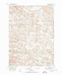
Bull Lake, NE
Old map for history, not navigation
USGS historical 15-minute topo (1951)

Carr Lake, NE
Old map for history, not navigation
USGS historical 15-minute topo (1948)

Carr Lake, NE
Old map for history, not navigation
USGS historical 15-minute topo (1950)

Cody Lake, NE
Old map for history, not navigation
USGS historical 15-minute topo (1949)

Cody Lake, NE
Old map for history, not navigation
USGS historical 15-minute topo (1951)

Cody, NE
Old map for history, not navigation
USGS historical 15-minute topo (1950)

Crescent Lake, NE
Old map for history, not navigation
USGS historical 15-minute topo (1950)

Dismal River Ranch, NE
Old map for history, not navigation
USGS historical 15-minute topo (1947)

Dismal River Ranch, NE
Old map for history, not navigation
USGS historical 15-minute topo (1949)

Dorchester, NE
Old map for history, not navigation
USGS historical 15-minute topo (1940)

Doughboy, NE
Old map for history, not navigation
USGS historical 15-minute topo (1950)

Doughboy, NE
Old map for history, not navigation
USGS historical 15-minute topo (1952)

Dunning, NE
Old map for history, not navigation
USGS historical 15-minute topo (1951)

Eli, NE
Old map for history, not navigation
USGS historical 15-minute topo (1952)

Falls City, NE
Old map for history, not navigation
USGS historical 15-minute topo (1915)

Flats, NE
Old map for history, not navigation
USGS historical 15-minute topo (1949)

Flats, NE
Old map for history, not navigation
USGS historical 15-minute topo (1950)

George Lake, NE
Old map for history, not navigation
USGS historical 15-minute topo (1948)

George Lake, NE
Old map for history, not navigation
USGS historical 15-minute topo (1950)

Grand Island, NE
Old map for history, not navigation
USGS historical 15-minute topo (1892)

Grand Island, NE
Old map for history, not navigation
USGS historical 15-minute topo (1895)

Gypsy Valley, NE
Old map for history, not navigation
USGS historical 15-minute topo (1951)

Halsey, NE
Old map for history, not navigation
USGS historical 15-minute topo (1948)

Halsey, NE
Old map for history, not navigation
USGS historical 15-minute topo (1950)

Hire, NE
Old map for history, not navigation
USGS historical 15-minute topo (1950)

Hoagland, NE
Old map for history, not navigation
USGS historical 15-minute topo (1951)

Howe, NE
Old map for history, not navigation
USGS historical 15-minute topo (1915)

Humboldt, NE
Old map for history, not navigation
USGS historical 15-minute topo (1916)

Irwin, NE
Old map for history, not navigation
USGS historical 15-minute topo (1950)

Irwin, NE
Old map for history, not navigation
USGS historical 15-minute topo (1951)

Kearney, NE
Old map for history, not navigation
USGS historical 15-minute topo (1894)

Kenesaw, NE
Old map for history, not navigation
USGS historical 15-minute topo (1894)

Kennedy, NE
Old map for history, not navigation
USGS historical 15-minute topo (1950)

Kilgore, NE
Old map for history, not navigation
USGS historical 15-minute topo (1950)

Kilpatrick Lake, NE
Old map for history, not navigation
USGS historical 15-minute topo (1951)

Koshopah, NE
Old map for history, not navigation
USGS historical 15-minute topo (1949)
Every Nebraska historical topo map by name
- Antioch, NE (1948)
- Antioch, NE (1949)
- Arabia, NE (1950)
- Arthur, NE (1949)
- Arthur, NE (1950)
- Ashby, NE (1948)
- Ashby, NE (1949)
- Big Falls, NE (1949)
- Big Falls, NE (1951)
- Bingham, NE (1948)
- Bingham, NE (1950)
- Brownlee, NE (1951)
- Bull Lake, NE (1951)
- Carr Lake, NE (1948)
- Carr Lake, NE (1950)
- Cody Lake, NE (1949)
- Cody Lake, NE (1951)
- Cody, NE (1950)
- Crescent Lake, NE (1950)
- Dismal River Ranch, NE (1947)
- Dismal River Ranch, NE (1949)
- Dorchester, NE (1940)
- Doughboy, NE (1950)
- Doughboy, NE (1952)
- Dunning, NE (1951)
- Eli, NE (1952)
- Falls City, NE (1915)
- Flats, NE (1949)
- Flats, NE (1950)
- George Lake, NE (1948)
- George Lake, NE (1950)
- Grand Island, NE (1892)
- Grand Island, NE (1895)
- Gypsy Valley, NE (1951)
- Halsey, NE (1948)
- Halsey, NE (1950)
- Hire, NE (1950)
- Hoagland, NE (1951)
- Howe, NE (1915)
- Humboldt, NE (1916)
- Irwin, NE (1950)
- Irwin, NE (1951)
- Kearney, NE (1894)
- Kenesaw, NE (1894)
- Kennedy, NE (1950)
- Kilgore, NE (1950)
- Kilpatrick Lake, NE (1951)
- Koshopah, NE (1949)
- Koshopah, NE (1951)
- Lakeside, NE (1948)
- Lakeside, NE (1950)
- Linscott, NE (1948)
- Linscott, NE (1950)
- Long Lake, NE (1949)
- Long Lake, NE (1951)
- Longfellow Lake, NE (1950)
- Lynn, NE (1949)
- Marsland, NE (1951)
- Merriman 4, NE (1951)
- Merriman, NE (1951)
- Minden, NE (1894)
- Moon Lake, NE (1951)
- Mullen, NE (1948)
- Mullen, NE (1951)
- Mumper, NE (1949)
- Nebraska City, NE (1907)
- Nehawka, NE (1935)
- Nehawka, NE (1940)
- Nemaha, NE (1915)
- Nemaha, NE (1939)
- Nemaha, NE (1949)
- Norden, NE (1950)
- Norden, NE (1952)
- Omaha, NE (1893)
- Powderhorn Valley, NE (1950)
- Purdum, NE (1949)
- Purdum, NE (1951)
- Rackett, NE (1949)
- Rackett, NE (1951)
- Red Cloud, NE (1940)
- Red Cloud, NE (1942)
- Seneca 4, NE (1948)
- Seneca 4, NE (1949)
- Seneca, NE (1948)
- Seneca, NE (1951)
- Seward, NE (1939)
- Shimmins Lake, NE (1950)
- Simeon, NE (1950)
- Skunk Lake, NE (1950)
- Spade Ranch, NE (1948)
- Spade Ranch, NE (1950)
- Sparks, NE (1950)
- Spring Valley, NE (1948)
- Spring Valley, NE (1950)
- Steverson Lake, NE (1949)
- Steverson Lake, NE (1951)
- Storm Lake, NE (1950)
- Thedford, NE (1948)
- Thedford, NE (1950)
- Tryon, NE (1951)
- Turpin Lake, NE (1949)
- Turpin Lake, NE (1951)
- Twin Lakes, NE (1948)
- Twin Lakes, NE (1950)
- Utica, NE (1934)
- Utica, NE (1937)
- Valentine, NE (1950)
- Velma, NE (1950)
- Whitman, NE (1948)
- Whitman, NE (1950)
- Wolf Lake, NE (1950)
- Wolf Lake, NE (1951)
- Wood Lake, NE (1950)
- Wood River, NE (1895)
- Wright Valley, NE (1949)
- Wright Valley, NE (1951)