Mississippi USGS topo maps
Cartahaven has 848 USGS topo maps of Mississippi, all free. These are the current USGS US Topo 7.5-minute (1:24,000) quadrangles: contours, roads, trails, streams and place names, each a GeoPDF.
Download one to your phone and the map app shows your GPS position on it with no cell signal.

Aberdeen, MS
Detailed map of terrain, trails and roads
USGS topo, 2024

Ackerman, MS
Detailed map of terrain, trails and roads
USGS topo, 2024

Agricola, MS
Detailed map of terrain, trails and roads
USGS topo, 2024

Airey, MS
Detailed map of terrain, trails and roads
USGS topo, 2024

Altitude, MS
Detailed map of terrain, trails and roads
USGS topo, 2024

Amory SE, MS
Detailed map of terrain, trails and roads
USGS topo, 2024
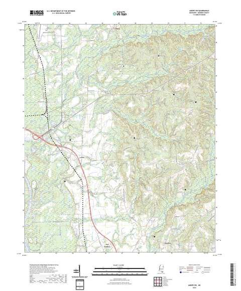
Amory SW, MS
Detailed map of terrain, trails and roads
USGS topo, 2024

Amory, MS
Detailed map of terrain, trails and roads
USGS topo, 2024

Angie, LA-MS
Detailed map of terrain, trails and roads
USGS topo, 2024

Angola, LA-MS
Detailed map of terrain, trails and roads
USGS topo, 2024

Aquilla, AL-MS
Detailed map of terrain, trails and roads
USGS topo, 2024

Arcola, MS
Detailed map of terrain, trails and roads
USGS topo, 2024

Arkabutla East, MS
Detailed map of terrain, trails and roads
USGS topo, 2024

Arkabutla West, MS
Detailed map of terrain, trails and roads
USGS topo, 2024

Arkansas City, AR-MS
Detailed map of terrain, trails and roads
USGS topo, 2024

Artesia, MS
Detailed map of terrain, trails and roads
USGS topo, 2024

Asa, MS
Detailed map of terrain, trails and roads
USGS topo, 2024

Ashland, MS
Detailed map of terrain, trails and roads
USGS topo, 2024

Ashly, LA-MS
Detailed map of terrain, trails and roads
USGS topo, 2024

Atlanta, MS
Detailed map of terrain, trails and roads
USGS topo, 2024

Auburn, MS
Detailed map of terrain, trails and roads
USGS topo, 2024

Avalon, MS
Detailed map of terrain, trails and roads
USGS topo, 2024

Avent, MS
Detailed map of terrain, trails and roads
USGS topo, 2024

Avera, MS
Detailed map of terrain, trails and roads
USGS topo, 2024

Avon, MS-AR
Detailed map of terrain, trails and roads
USGS topo, 2024

Bagley Lake, MS
Detailed map of terrain, trails and roads
USGS topo, 2024

Bailey Lake, MS
Detailed map of terrain, trails and roads
USGS topo, 2024

Baldwyn, MS
Detailed map of terrain, trails and roads
USGS topo, 2024

Baltzer, MS
Detailed map of terrain, trails and roads
USGS topo, 2024

Banks, MS
Detailed map of terrain, trails and roads
USGS topo, 2024

Banner, MS
Detailed map of terrain, trails and roads
USGS topo, 2024

Barbara, MS
Detailed map of terrain, trails and roads
USGS topo, 2024

Barge Lake, MS
Detailed map of terrain, trails and roads
USGS topo, 2024

Barlow, MS
Detailed map of terrain, trails and roads
USGS topo, 2024

Barrontown, MS
Detailed map of terrain, trails and roads
USGS topo, 2024

Basin, MS
Detailed map of terrain, trails and roads
USGS topo, 2024

Bassfield, MS
Detailed map of terrain, trails and roads
USGS topo, 2024

Batesville, MS
Detailed map of terrain, trails and roads
USGS topo, 2024

Baxterville NE, MS
Detailed map of terrain, trails and roads
USGS topo, 2024

Baxterville SW, MS-LA
Detailed map of terrain, trails and roads
USGS topo, 2024

Baxterville, MS
Detailed map of terrain, trails and roads
USGS topo, 2024

Bay Saint Louis, MS
Detailed map of terrain, trails and roads
USGS topo, 2024

Bay Springs, MS
Detailed map of terrain, trails and roads
USGS topo, 2024

Bayland SE, MS
Detailed map of terrain, trails and roads
USGS topo, 2024

Bayland, MS
Detailed map of terrain, trails and roads
USGS topo, 2024

Beans Ferry, MS
Detailed map of terrain, trails and roads
USGS topo, 2024

Bear Gut Bayou, MS
Detailed map of terrain, trails and roads
USGS topo, 2024

Beatrice, MS
Detailed map of terrain, trails and roads
USGS topo, 2024