Maryland historical topo maps
Cartahaven has 149 historical topo maps of Maryland, all free. These are the USGS 15-minute (1:62,500) quadrangles from the mid-1900s: old roads, mines, homesteads, rail lines and place names that newer maps leave off.
Download one to your phone and the map app shows your GPS position on it with no cell signal.

Accident, MD
Old map for history, not navigation
USGS historical 15-minute topo (1900)

Annapolis, MD
Old map for history, not navigation
USGS historical 15-minute topo (1892)

Annapolis, MD
Old map for history, not navigation
USGS historical 15-minute topo (1904)

Antietam, MD
Old map for history, not navigation
USGS historical 15-minute topo (1910)

Baltimore, MD
Old map for history, not navigation
USGS historical 15-minute topo (1894)

Baltimore, MD
Old map for history, not navigation
USGS historical 15-minute topo (1899)

Baltimore, MD
Old map for history, not navigation
USGS historical 15-minute topo (1904)

Baltimore, MD
Old map for history, not navigation
USGS historical 15-minute topo (1943)

Baltimore, MD
Old map for history, not navigation
USGS historical 15-minute topo (1944)

Barclay, MD
Old map for history, not navigation
USGS historical 15-minute topo (1905)

Barclay, MD
Old map for history, not navigation
USGS historical 15-minute topo (1951)

Bel Air, MD
Old map for history, not navigation
USGS historical 15-minute topo (1942)

Bel Air, MD
Old map for history, not navigation
USGS historical 15-minute topo (1945)

Belair, MD
Old map for history, not navigation
USGS historical 15-minute topo (1901)

Belair, MD
Old map for history, not navigation
USGS historical 15-minute topo (1948)

Belair, MD
Old map for history, not navigation
USGS historical 15-minute topo (1963)

Betterton, MD
Old map for history, not navigation
USGS historical 15-minute topo (1900)

Betterton, MD
Old map for history, not navigation
USGS historical 15-minute topo (1951)

Bloodsworth Island, MD
Old map for history, not navigation
USGS historical 15-minute topo (1903)

Brandywine, MD
Old map for history, not navigation
USGS historical 15-minute topo (1892)

Brandywine, MD
Old map for history, not navigation
USGS historical 15-minute topo (1895)

Brandywine, MD
Old map for history, not navigation
USGS historical 15-minute topo (1911)

Brandywine, MD
Old map for history, not navigation
USGS historical 15-minute topo (1913)

Cecilton, MD
Old map for history, not navigation
USGS historical 15-minute topo (1900)

Cecilton, MD
Old map for history, not navigation
USGS historical 15-minute topo (1951)

Chestertown, MD
Old map for history, not navigation
USGS historical 15-minute topo (1901)
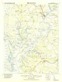
Chestertown, MD
Old map for history, not navigation
USGS historical 15-minute topo (1920)

Chestertown, MD
Old map for history, not navigation
USGS historical 15-minute topo (1951)

Crapo, MD
Old map for history, not navigation
USGS historical 15-minute topo (1905)

Crisfield, MD
Old map for history, not navigation
USGS historical 15-minute topo (1903)

Crisfield, MD
Old map for history, not navigation
USGS historical 15-minute topo (1920)

Deal Island, MD
Old map for history, not navigation
USGS historical 15-minute topo (1903)

Denton, MD
Old map for history, not navigation
USGS historical 15-minute topo (1905)

Drum Point, MD
Old map for history, not navigation
USGS historical 15-minute topo (1892)

Drum Point, MD
Old map for history, not navigation
USGS historical 15-minute topo (1901)

Drum Point, MD
Old map for history, not navigation
USGS historical 15-minute topo (1905)

Drum Point, MD
Old map for history, not navigation
USGS historical 15-minute topo (1942)

Elkton, MD
Old map for history, not navigation
USGS historical 15-minute topo (1898)

Elkton, MD
Old map for history, not navigation
USGS historical 15-minute topo (1900)

Elkton, MD
Old map for history, not navigation
USGS historical 15-minute topo (1917)

Elkton, MD
Old map for history, not navigation
USGS historical 15-minute topo (1942)

Ellicott, MD
Old map for history, not navigation
USGS historical 15-minute topo (1892)

Ellicott, MD
Old map for history, not navigation
USGS historical 15-minute topo (1894)

Ellicott, MD
Old map for history, not navigation
USGS historical 15-minute topo (1906)

Emmitsburg, MD
Old map for history, not navigation
USGS historical 15-minute topo (1911)

Emmitsburg, MD
Old map for history, not navigation
USGS historical 15-minute topo (1943)

Flintstone, MD
Old map for history, not navigation
USGS historical 15-minute topo (1899)

Flintstone, MD
Old map for history, not navigation
USGS historical 15-minute topo (1900)
Every Maryland historical topo map by name
- Accident, MD (1900)
- Annapolis, MD (1892)
- Annapolis, MD (1904)
- Antietam, MD (1910)
- Baltimore, MD (1894)
- Baltimore, MD (1899)
- Baltimore, MD (1904)
- Baltimore, MD (1943)
- Baltimore, MD (1944)
- Barclay, MD (1905)
- Barclay, MD (1951)
- Bel Air, MD (1942)
- Bel Air, MD (1945)
- Belair, MD (1901)
- Belair, MD (1948)
- Belair, MD (1963)
- Betterton, MD (1900)
- Betterton, MD (1951)
- Bloodsworth Island, MD (1903)
- Brandywine, MD (1892)
- Brandywine, MD (1895)
- Brandywine, MD (1911)
- Brandywine, MD (1913)
- Cecilton, MD (1900)
- Cecilton, MD (1951)
- Chestertown, MD (1901)
- Chestertown, MD (1920)
- Chestertown, MD (1951)
- Crapo, MD (1905)
- Crisfield, MD (1903)
- Crisfield, MD (1920)
- Deal Island, MD (1903)
- Denton, MD (1905)
- Drum Point, MD (1892)
- Drum Point, MD (1901)
- Drum Point, MD (1905)
- Drum Point, MD (1942)
- Elkton, MD (1898)
- Elkton, MD (1900)
- Elkton, MD (1917)
- Elkton, MD (1942)
- Ellicott, MD (1892)
- Ellicott, MD (1894)
- Ellicott, MD (1906)
- Emmitsburg, MD (1911)
- Emmitsburg, MD (1943)
- Flintstone, MD (1899)
- Flintstone, MD (1900)
- Frederick, MD (1942)
- Frostburg, MD (1898)
- Frostburg, MD (1901)
- Frostburg, MD (1908)
- Frostburg, MD (1950)
- Frostburg, MD (1951)
- Grantsville, MD (1899)
- Grantsville, MD (1904)
- Green Run, MD (1901)
- Green Run, MD (1938)
- Green Run, MD (1944)
- Gunpowder, MD (1893)
- Gunpowder, MD (1901)
- Gunpowder, MD (1941)
- Gunpowder, MD (1949)
- Hagerstown, MD (1912)
- Hancock, MD (1901)
- Havre De Grace, MD (1900)
- Havre De Grace, MD (1942)
- Hurlock, MD (1905)
- Ijamsville, MD (1908)
- Ijamsville, MD (1909)
- Indian Head, MD (1913)
- Indian Head, MD (1925)
- Indian Head, MD (1956)
- Laurel, MD (1892)
- Laurel, MD (1894)
- Laurel, MD (1897)
- Laurel, MD (1907)
- Laurel, MD (1926)
- Laurel, MD (1942)
- Laurel, MD (1949)
- Leonardtown, MD (1892)
- Leonardtown, MD (1895)
- Leonardtown, MD (1901)
- Leonardtown, MD (1939)
- Leonardtown, MD (1950)
- Montross, MD (1892)
- Montross, MD (1895)
- Mount Airy, MD (1909)
- Mount Airy, MD (1945)
- Nanjemoy, MD (1913)
- Nanjemoy, MD (1948)
- Nanticoke, MD (1903)
- North Point, MD (1893)
- North Point, MD (1904)
- North Point, MD (1943)
- North Point, MD (1947)
- Oakland, MD (1899)
- Oakland, MD (1900)
- Ocean City, MD (1901)
- Ocean City, MD (1942)
- Ocean City, MD (1961)
- Owensville, MD (1892)
- Owensville, MD (1895)
- Owensville, MD (1905)
- Oxford, MD (1904)
- Parkton, MD (1900)
- Parkton, MD (1902)
- Paw Paw, MD (1898)
- Paw Paw, MD (1900)
- Paw Paw, MD (1910)
- Piney Point, MD (1892)
- Piney Point, MD (1894)
- Piney Point, MD (1895)
- Piney Point, MD (1901)
- Pittsville, MD (1902)
- Point Lookout, MD (1894)
- Point Lookout, MD (1912)
- Point Lookout, MD (1937)
- Prince Frederick, MD (1892)
- Prince Frederick, MD (1895)
- Prince Frederick, MD (1901)
- Prince Frederick, MD (1910)
- Prince Frederick, MD (1938)
- Relay, MD (1894)
- Relay, MD (1907)
- Relay, MD (1947)
- Rockville, MD (1908)
- Rockville, MD (1923)
- Rockville, MD (1944)
- Salisbury, MD (1901)
- Seneca, MD (1908)
- Seneca, MD (1944)
- Sharps Island, MD (1893)
- Sharps Island, MD (1904)
- Snow Hill, MD (1901)
- St Michaels, MD (1904)
- Taneytown, MD (1911)
- Upper Marlboro, MD (1934)
- Upper Marlboro, MD (1937)
- Upper Marlboro, MD (1938)
- Washington, MD (1900)
- Westminster, MD (1905)
- Wicomico, MD (1894)
- Wicomico, MD (1895)
- Wicomico, MD (1902)
- Wicomico, MD (1911)
- Wicomico, MD (1914)
- Wicomico, MD (1920)
- Williamsport, MD (1944)