Kentucky historical topo maps
Cartahaven has 137 historical topo maps of Kentucky, all free. These are the USGS 15-minute (1:62,500) quadrangles from the mid-1900s: old roads, mines, homesteads, rail lines and place names that newer maps leave off.
Download one to your phone and the map app shows your GPS position on it with no cell signal.

Alexandria, KY
Old map for history, not navigation
USGS historical 15-minute topo (1936)

Barthell, KY
Old map for history, not navigation
USGS historical 15-minute topo (1934)

Benton, KY
Old map for history, not navigation
USGS historical 15-minute topo (1955)

Big Clifty, KY
Old map for history, not navigation
USGS historical 15-minute topo (1932)

Big Clifty, KY
Old map for history, not navigation
USGS historical 15-minute topo (1949)

Bowling Green, KY
Old map for history, not navigation
USGS historical 15-minute topo (1921)

Bowling Green, KY
Old map for history, not navigation
USGS historical 15-minute topo (1923)

Brownsville, KY
Old map for history, not navigation
USGS historical 15-minute topo (1922)

Brownsville, KY
Old map for history, not navigation
USGS historical 15-minute topo (1923)

Buckhorn, KY
Old map for history, not navigation
USGS historical 15-minute topo (1913)

Burnside, KY
Old map for history, not navigation
USGS historical 15-minute topo (1932)

Byrdstown, KY
Old map for history, not navigation
USGS historical 15-minute topo (1929)

Calhoun, KY
Old map for history, not navigation
USGS historical 15-minute topo (1908)

Cannelton, KY
Old map for history, not navigation
USGS historical 15-minute topo (1934)

Cave In Rock, KY
Old map for history, not navigation
USGS historical 15-minute topo (1925)
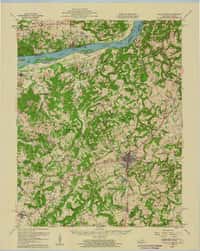
Cave In Rock, KY
Old map for history, not navigation
USGS historical 15-minute topo (1958)

Central City, KY
Old map for history, not navigation
USGS historical 15-minute topo (1909)

Cornettsville, KY
Old map for history, not navigation
USGS historical 15-minute topo (1916)

Cub Run, KY
Old map for history, not navigation
USGS historical 15-minute topo (1925)

Cynthiana, KY
Old map for history, not navigation
USGS historical 15-minute topo (1934)
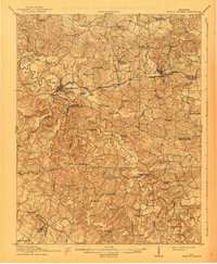
Dawson Springs, KY
Old map for history, not navigation
USGS historical 15-minute topo (1911)

Drakesboro, KY
Old map for history, not navigation
USGS historical 15-minute topo (1913)

Dunmor, KY
Old map for history, not navigation
USGS historical 15-minute topo (1914)

Earlington, KY
Old map for history, not navigation
USGS historical 15-minute topo (1909)

Earlington, KY
Old map for history, not navigation
USGS historical 15-minute topo (1954)

Eddyville, KY
Old map for history, not navigation
USGS historical 15-minute topo (1931)

Eddyville, KY
Old map for history, not navigation
USGS historical 15-minute topo (1955)

Ekron, KY
Old map for history, not navigation
USGS historical 15-minute topo (1941)

Ekron, KY
Old map for history, not navigation
USGS historical 15-minute topo (1947)

Elizabethtown, KY
Old map for history, not navigation
USGS historical 15-minute topo (1938)

Elizabethtown, KY
Old map for history, not navigation
USGS historical 15-minute topo (1949)

Falmouth, KY
Old map for history, not navigation
USGS historical 15-minute topo (1936)

Fancy Farm, KY
Old map for history, not navigation
USGS historical 15-minute topo (1952)

Fordsville, KY
Old map for history, not navigation
USGS historical 15-minute topo (1932)

Frankfort, KY
Old map for history, not navigation
USGS historical 15-minute topo (1924)

Georgetown, KY
Old map for history, not navigation
USGS historical 15-minute topo (1906)

Georgetown, KY
Old map for history, not navigation
USGS historical 15-minute topo (1908)

Golconda, KY
Old map for history, not navigation
USGS historical 15-minute topo (1921)

Golconda, KY
Old map for history, not navigation
USGS historical 15-minute topo (1959)

Golden Pond, KY
Old map for history, not navigation
USGS historical 15-minute topo (1955)

Greenup, KY
Old map for history, not navigation
USGS historical 15-minute topo (1926)

Greenup, KY
Old map for history, not navigation
USGS historical 15-minute topo (1930)

Hardinsburg, KY
Old map for history, not navigation
USGS historical 15-minute topo (1931)

Hardinsburg, KY
Old map for history, not navigation
USGS historical 15-minute topo (1947)

Harlan, KY
Old map for history, not navigation
USGS historical 15-minute topo (1919)

Harold, KY
Old map for history, not navigation
USGS historical 15-minute topo (1916)

Hartford, KY
Old map for history, not navigation
USGS historical 15-minute topo (1909)

Henderson, KY
Old map for history, not navigation
USGS historical 15-minute topo (1916)
Every Kentucky historical topo map by name
- Alexandria, KY (1936)
- Barthell, KY (1934)
- Benton, KY (1955)
- Big Clifty, KY (1932)
- Big Clifty, KY (1949)
- Bowling Green, KY (1921)
- Bowling Green, KY (1923)
- Brownsville, KY (1922)
- Brownsville, KY (1923)
- Buckhorn, KY (1913)
- Burnside, KY (1932)
- Byrdstown, KY (1929)
- Calhoun, KY (1908)
- Cannelton, KY (1934)
- Cave In Rock, KY (1925)
- Cave In Rock, KY (1958)
- Central City, KY (1909)
- Cornettsville, KY (1916)
- Cub Run, KY (1925)
- Cynthiana, KY (1934)
- Dawson Springs, KY (1911)
- Drakesboro, KY (1913)
- Dunmor, KY (1914)
- Earlington, KY (1909)
- Earlington, KY (1954)
- Eddyville, KY (1931)
- Eddyville, KY (1955)
- Ekron, KY (1941)
- Ekron, KY (1947)
- Elizabethtown, KY (1938)
- Elizabethtown, KY (1949)
- Falmouth, KY (1936)
- Fancy Farm, KY (1952)
- Fordsville, KY (1932)
- Frankfort, KY (1924)
- Georgetown, KY (1906)
- Georgetown, KY (1908)
- Golconda, KY (1921)
- Golconda, KY (1959)
- Golden Pond, KY (1955)
- Greenup, KY (1926)
- Greenup, KY (1930)
- Hardinsburg, KY (1931)
- Hardinsburg, KY (1947)
- Harlan, KY (1919)
- Harold, KY (1916)
- Hartford, KY (1909)
- Henderson, KY (1916)
- Hickman, KY (1939)
- Hickman, KY (1954)
- Hickman, KY (1955)
- Hickman, KY (1972)
- Hickory, KY (1951)
- Hindman, KY (1915)
- Horse Cave, KY (1938)
- Hurley, KY (1917)
- Hyden, KY (1919)
- Inez, KY (1916)
- Kosmosdale, KY (1912)
- Kosmosdale, KY (1950)
- La Center, KY (1928)
- La Center, KY (1932)
- La Grange, KY (1932)
- Leitchfield, KY (1925)
- Lexington, KY (1929)
- Little Muddy, KY (1914)
- Lockport, KY (1906)
- Lockport, KY (1908)
- Louisa, KY (1939)
- Louisville, KY (1907)
- Louisville, KY (1951)
- Madisonville, KY (1909)
- Mammoth Cave, KY (1922)
- Mammoth Cave, KY (1923)
- Matewan, KY (1928)
- Mayfield, KY (1952)
- Middlesboro, KY (1927)
- Middlesboro, KY (1930)
- Monticello, KY (1911)
- Monticello, KY (1914)
- Morehead, KY (1935)
- Morganfield, KY (1907)
- Mount Eden, KY (1927)
- Munfordville, KY (1937)
- Murray, KY (1951)
- New Castle, KY (1932)
- New Concord, KY (1955)
- Newburg, KY (1905)
- Nolansburg, KY (1919)
- Nortonville, KY (1912)
- Paducah, KY (1926)
- Paducah, KY (1929)
- Paducah, KY (1940)
- Paintsville, KY (1917)
- Pall Mall, KY (1934)
- Pikeville, KY (1916)
- Prestonsburg, KY (1915)
- Prestonsburg, KY (1918)
- Princeton, KY (1908)
- Princeton, KY (1910)
- Prospect, KY (1905)
- Prospect, KY (1912)
- Providence, KY (1909)
- Providence, KY (1954)
- Regina, KY (1915)
- Regina, KY (1917)
- Sadieville, KY (1939)
- Salt Lick, KY (1929)
- Salt Lick, KY (1934)
- Scottsville, KY (1926)
- Sebree, KY (1906)
- Shepherdsville, KY (1949)
- Smithland, KY (1929)
- Smithland, KY (1942)
- Somerset, KY (1935)
- Spring Lick, KY (1925)
- Springdale, KY (1929)
- Springdale, KY (1935)
- Sutherland, KY (1906)
- Taylorsville, KY (1929)
- Tell City, KY (1903)
- Tompkinsville, KY (1929)
- Troublesome, KY (1914)
- Uniontown, KY (1917)
- Vanceburg, KY (1949)
- Vine Grove, KY (1936)
- Vine Grove, KY (1943)
- Vine Grove, KY (1946)
- Water Valley, KY (1952)
- Whitesburg, KY (1915)
- Whitesville, KY (1907)
- Whitesville, KY (1909)
- Wickliffe, KY (1952)
- Wickliffe, KY (1955)
- Wickliffe, KY (1972)
- Williamson, KY (1915)
- Williamson, KY (1918)