Colorado historical topo maps
Cartahaven has 165 historical topo maps of Colorado, all free. These are the USGS 15-minute (1:62,500) quadrangles from the mid-1900s: old roads, mines, homesteads, rail lines and place names that newer maps leave off.
Download one to your phone and the map app shows your GPS position on it with no cell signal.

Antero Reservoir, CO
Old map for history, not navigation
USGS historical 15-minute topo (1959)

Anthracite, CO
Old map for history, not navigation
USGS historical 15-minute topo (1888)

Anthracite, CO
Old map for history, not navigation
USGS historical 15-minute topo (1889)

Anthracite, CO
Old map for history, not navigation
USGS historical 15-minute topo (1893)

Anthracite, CO
Old map for history, not navigation
USGS historical 15-minute topo (1894)

Aspen, CO
Old map for history, not navigation
USGS historical 15-minute topo (1893)
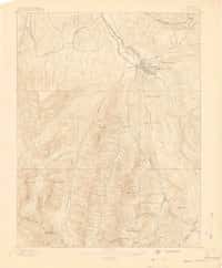
Aspen, CO
Old map for history, not navigation
USGS historical 15-minute topo (1895)

Axial, CO
Old map for history, not navigation
USGS historical 15-minute topo (1912)
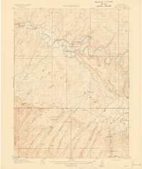
Axial, CO
Old map for history, not navigation
USGS historical 15-minute topo (1914)

Black Mountain, CO
Old map for history, not navigation
USGS historical 15-minute topo (1959)

Blackhawk, CO
Old map for history, not navigation
USGS historical 15-minute topo (1906)

Bonanza, CO
Old map for history, not navigation
USGS historical 15-minute topo (1959)

Bonny Reservoir, CO
Old map for history, not navigation
USGS historical 15-minute topo (1950)

Boulder, CO
Old map for history, not navigation
USGS historical 15-minute topo (1902)

Boulder, CO
Old map for history, not navigation
USGS historical 15-minute topo (1904)
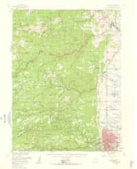
Boulder, CO
Old map for history, not navigation
USGS historical 15-minute topo (1957)

Bristol Head, CO
Old map for history, not navigation
USGS historical 15-minute topo (1959)

Buena Vista, CO
Old map for history, not navigation
USGS historical 15-minute topo (1955)

Cameron Mountain, CO
Old map for history, not navigation
USGS historical 15-minute topo (1956)

Castle Rock, CO
Old map for history, not navigation
USGS historical 15-minute topo (1940)

Castle Rock, CO
Old map for history, not navigation
USGS historical 15-minute topo (1945)

Central City, CO
Old map for history, not navigation
USGS historical 15-minute topo (1905)

Central City, CO
Old map for history, not navigation
USGS historical 15-minute topo (1910)

Central City, CO
Old map for history, not navigation
USGS historical 15-minute topo (1912)

Chama Peak, CO
Old map for history, not navigation
USGS historical 15-minute topo (1957)

Chromo, CO
Old map for history, not navigation
USGS historical 15-minute topo (1957)

Citadel Plateau, CO
Old map for history, not navigation
USGS historical 15-minute topo (1958)

Colorado Springs, CO
Old map for history, not navigation
USGS historical 15-minute topo (1948)

Colorado Springs, CO
Old map for history, not navigation
USGS historical 15-minute topo (1951)

Como, CO
Old map for history, not navigation
USGS historical 15-minute topo (1937)

Como, CO
Old map for history, not navigation
USGS historical 15-minute topo (1958)

Cotopaxi, CO
Old map for history, not navigation
USGS historical 15-minute topo (1959)

Cover Mtn, CO
Old map for history, not navigation
USGS historical 15-minute topo (1942)

Cover Mtn, CO
Old map for history, not navigation
USGS historical 15-minute topo (1948)

Cowdrey, CO
Old map for history, not navigation
USGS historical 15-minute topo (1956)

Creede, CO
Old map for history, not navigation
USGS historical 15-minute topo (1959)

Crested Butte, CO
Old map for history, not navigation
USGS historical 15-minute topo (1888)

Crested Butte, CO
Old map for history, not navigation
USGS historical 15-minute topo (1889)

Crested Butte, CO
Old map for history, not navigation
USGS historical 15-minute topo (1893)

Daton Peak, CO
Old map for history, not navigation
USGS historical 15-minute topo (1916)

Daton Peak, CO
Old map for history, not navigation
USGS historical 15-minute topo (1920)

Dillon, CO
Old map for history, not navigation
USGS historical 15-minute topo (1929)

Dillon, CO
Old map for history, not navigation
USGS historical 15-minute topo (1934)

Durango, CO
Old map for history, not navigation
USGS historical 15-minute topo (1898)

Durango, CO
Old map for history, not navigation
USGS historical 15-minute topo (1907)

Durango, CO
Old map for history, not navigation
USGS historical 15-minute topo (1908)

Elbert, CO
Old map for history, not navigation
USGS historical 15-minute topo (1940)
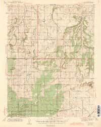
Elbert, CO
Old map for history, not navigation
USGS historical 15-minute topo (1944)
Every Colorado historical topo map by name
- Antero Reservoir, CO (1959)
- Anthracite, CO (1888)
- Anthracite, CO (1889)
- Anthracite, CO (1893)
- Anthracite, CO (1894)
- Aspen, CO (1893)
- Aspen, CO (1895)
- Axial, CO (1912)
- Axial, CO (1914)
- Black Mountain, CO (1959)
- Blackhawk, CO (1906)
- Bonanza, CO (1959)
- Bonny Reservoir, CO (1950)
- Boulder, CO (1902)
- Boulder, CO (1904)
- Boulder, CO (1957)
- Bristol Head, CO (1959)
- Buena Vista, CO (1955)
- Cameron Mountain, CO (1956)
- Castle Rock, CO (1940)
- Castle Rock, CO (1945)
- Central City, CO (1905)
- Central City, CO (1910)
- Central City, CO (1912)
- Chama Peak, CO (1957)
- Chromo, CO (1957)
- Citadel Plateau, CO (1958)
- Colorado Springs, CO (1948)
- Colorado Springs, CO (1951)
- Como, CO (1937)
- Como, CO (1958)
- Cotopaxi, CO (1959)
- Cover Mtn, CO (1942)
- Cover Mtn, CO (1948)
- Cowdrey, CO (1956)
- Creede, CO (1959)
- Crested Butte, CO (1888)
- Crested Butte, CO (1889)
- Crested Butte, CO (1893)
- Daton Peak, CO (1916)
- Daton Peak, CO (1920)
- Dillon, CO (1929)
- Dillon, CO (1934)
- Durango, CO (1898)
- Durango, CO (1907)
- Durango, CO (1908)
- Elbert, CO (1940)
- Elbert, CO (1944)
- Electric Peak, CO (1959)
- Elizabeth, CO (1939)
- Elizabeth, CO (1945)
- Elk Springs, CO (1960)
- Elkhead Creek, CO (1923)
- Elkhead Creek, CO (1924)
- Engineer Mountain, CO (1898)
- Engineer Mountain, CO (1900)
- Engineer Mountain, CO (1908)
- Falcon, CO (1948)
- Falcon, CO (1951)
- Florissant, CO (1959)
- Fort Collins, CO (1906)
- Fort Collins, CO (1908)
- Fountain, CO (1951)
- Fraser, CO (1924)
- Fraser, CO (1926)
- Fraser, CO (1957)
- Garfield, CO (1940)
- Garfield, CO (1945)
- Gateway, CO (1960)
- Georgetown, CO (1903)
- Georgetown, CO (1905)
- Georgetown, CO (1957)
- Gore Pass, CO (1956)
- Gould, CO (1956)
- Grand Valley, CO (1929)
- Guffey, CO (1959)
- Highmore, CO (1929)
- Holy Cross, CO (1949)
- Holy Cross, CO (1951)
- Hot Sulphur Springs, CO (1957)
- Howard, CO (1959)
- Hyannis Peak, CO (1956)
- Jasper, CO (1967)
- Kings Canyon, CO (1955)
- Kremmling, CO (1956)
- La Plata, CO (1895)
- La Plata, CO (1897)
- La Plata, CO (1899)
- La Plata, CO (1908)
- Lake City, CO (1903)
- Lake City, CO (1905)
- Lone Mountain, CO (1960)
- Loveland, CO (1906)
- Loveland, CO (1908)
- Maybell, CO (1958)
- Meeker, CO (1912)
- Meeker, CO (1914)
- Minturn, CO (1934)
- Minturn, CO (1950)
- Montezuma, CO (1924)
- Montezuma, CO (1926)
- Montezuma, CO (1933)
- Montezuma, CO (1958)
- Montezuma, CO (1974)
- Monument Butte, CO (1915)
- Mount Big Chief, CO (1948)
- Mount Big Chief, CO (1951)
- Mount Elbert, CO (1935)
- Mount Elbert, CO (1938)
- Mount Elbert, CO (1939)
- Mount Ethel, CO (1955)
- Mount Gunnison, CO (1938)
- Mount Harris, CO (1924)
- Mount Harris, CO (1926)
- Mount Harvard, CO (1955)
- Mount Lincoln, CO (1938)
- Mount Olympus, CO (1905)
- Mount Powell, CO (1933)
- Mt Gunnison, CO (1945)
- Mt Lincoln, CO (1945)
- Mt Olympus, CO (1907)
- Mt Powell, CO (1940)
- Needle Mountains, CO (1900)
- Needle Mountains, CO (1902)
- Niwot, CO (1904)
- Nucla, CO (1960)
- Ouray, CO (1902)
- Ouray, CO (1904)
- Pagosa Junction, CO (1957)
- Parachute Creek, CO (1925)
- Parachute Creek, CO (1927)
- Paradox, CO (1960)
- Pearl, CO (1956)
- Pikes Peak, CO (1901)
- Pilot Knob, CO (1923)
- Pilot Knob, CO (1925)
- Pitkin, CO (1941)
- Pitkin, CO (1945)
- Platoro, CO (1967)
- Poncha Springs, CO (1956)
- Rabbit Ears Peak, CO (1956)
- Rand, CO (1956)
- Red Mesa, CO (1913)
- Rico, CO (1897)
- Rico, CO (1898)
- Rico, CO (1899)
- Roan Creek, CO (1929)
- Royal Gorge, CO (1959)
- Silverton, CO (1897)
- Silverton, CO (1901)
- Silverton, CO (1902)
- Silverton, CO (1955)
- Slick Rock, CO (1960)
- Soda Canyon, CO (1912)
- Soda Canyon, CO (1915)
- Spar City, CO (1957)
- Taylor Park, CO (1934)
- Taylor Park, CO (1937)
- Telluride, CO (1897)
- Telluride, CO (1904)
- Telluride, CO (1955)
- Ute Peak, CO (1933)
- Ute Peak, CO (1937)
- Walden, CO (1955)
- Wolf Creek Pass, CO (1957)