California historical topo maps
Cartahaven has 1,224 historical topo maps of California, all free. These are the USGS 15-minute (1:62,500) quadrangles from the mid-1900s: old roads, mines, homesteads, rail lines and place names that newer maps leave off.
Download one to your phone and the map app shows your GPS position on it with no cell signal.

Acolita, CA
Old map for history, not navigation
USGS historical 15-minute topo (1953)

Acton, CA
Old map for history, not navigation
USGS historical 15-minute topo (1940)

Acton, CA
Old map for history, not navigation
USGS historical 15-minute topo (1959)

Adelaida, CA
Old map for history, not navigation
USGS historical 15-minute topo (1919)

Adelaida, CA
Old map for history, not navigation
USGS historical 15-minute topo (1932)

Adelaida, CA
Old map for history, not navigation
USGS historical 15-minute topo (1942)

Adelaida, CA
Old map for history, not navigation
USGS historical 15-minute topo (1947)

Adelaida, CA
Old map for history, not navigation
USGS historical 15-minute topo (1961)

Adin, CA
Old map for history, not navigation
USGS historical 15-minute topo (1962)

Agua Dulce, CA
Old map for history, not navigation
USGS historical 15-minute topo (1942)

Agua Dulce, CA
Old map for history, not navigation
USGS historical 15-minute topo (1944)

Agua Dulce, CA
Old map for history, not navigation
USGS historical 15-minute topo (1947)

Agua Dulce, CA
Old map for history, not navigation
USGS historical 15-minute topo (1952)

Alamorio, CA
Old map for history, not navigation
USGS historical 15-minute topo (1940)

Alamorio, CA
Old map for history, not navigation
USGS historical 15-minute topo (1945)

Albion, CA
Old map for history, not navigation
USGS historical 15-minute topo (1943)

Alderpoint, CA
Old map for history, not navigation
USGS historical 15-minute topo (1949)

Alderpoint, CA
Old map for history, not navigation
USGS historical 15-minute topo (1951)

Alleghany, CA
Old map for history, not navigation
USGS historical 15-minute topo (1950)

Almanor, CA
Old map for history, not navigation
USGS historical 15-minute topo (1955)

Alpine Butte, CA
Old map for history, not navigation
USGS historical 15-minute topo (1945)

Altamont, CA
Old map for history, not navigation
USGS historical 15-minute topo (1942)

Alturas, CA
Old map for history, not navigation
USGS historical 15-minute topo (1961)

Alvord Mountain, CA
Old map for history, not navigation
USGS historical 15-minute topo (1948)

Alvord Mountain, CA
Old map for history, not navigation
USGS historical 15-minute topo (1951)

Anada, CA
Old map for history, not navigation
USGS historical 15-minute topo (1918)

Anaheim, CA
Old map for history, not navigation
USGS historical 15-minute topo (1896)

Anaheim, CA
Old map for history, not navigation
USGS historical 15-minute topo (1898)

Anaheim, CA
Old map for history, not navigation
USGS historical 15-minute topo (1901)
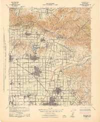
Anaheim, CA
Old map for history, not navigation
USGS historical 15-minute topo (1942)
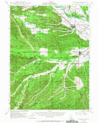
Anderson, CA
Old map for history, not navigation
USGS historical 15-minute topo (1947)

Anderson, CA
Old map for history, not navigation
USGS historical 15-minute topo (1948)

Ano Nuevo Pt, CA
Old map for history, not navigation
USGS historical 15-minute topo (1941)

Ano Nuevo, CA
Old map for history, not navigation
USGS historical 15-minute topo (1940)

Ano Nuevo, CA
Old map for history, not navigation
USGS historical 15-minute topo (1942)

Ano Nuevo, CA
Old map for history, not navigation
USGS historical 15-minute topo (1948)

Antelope Mtn, CA
Old map for history, not navigation
USGS historical 15-minute topo (1956)

Anthony Peak, CA
Old map for history, not navigation
USGS historical 15-minute topo (1952)

Antioch, CA
Old map for history, not navigation
USGS historical 15-minute topo (1907)

Antioch, CA
Old map for history, not navigation
USGS historical 15-minute topo (1908)

Apple Valley, CA
Old map for history, not navigation
USGS historical 15-minute topo (1957)

Arroyo Grande, CA
Old map for history, not navigation
USGS historical 15-minute topo (1897)

Arroyo Grande, CA
Old map for history, not navigation
USGS historical 15-minute topo (1942)

Arroyo Grande, CA
Old map for history, not navigation
USGS historical 15-minute topo (1952)

Athlone, CA
Old map for history, not navigation
USGS historical 15-minute topo (1942)

Atwater, CA
Old map for history, not navigation
USGS historical 15-minute topo (1961)
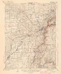
Auburn, CA
Old map for history, not navigation
USGS historical 15-minute topo (1944)

Auburn, CA
Old map for history, not navigation
USGS historical 15-minute topo (1954)
More California maps
- California USGS topo maps (2,881)
- California Forest Service FSTopo maps (1,009)
- California wildlife area maps (240)
- California national forest maps (46)
- California national park maps (21)
- California BLM maps (21)
- California wildlife refuge maps (15)
- California geologic maps (1)
- All California topo and trail maps