Arkansas historical topo maps
Cartahaven has 290 historical topo maps of Arkansas, all free. These are the USGS 15-minute (1:62,500) quadrangles from the mid-1900s: old roads, mines, homesteads, rail lines and place names that newer maps leave off.
Download one to your phone and the map app shows your GPS position on it with no cell signal.

Alexander, AR
Old map for history, not navigation
USGS historical 15-minute topo (1935)

Alexander, AR
Old map for history, not navigation
USGS historical 15-minute topo (1941)

Alicia, AR
Old map for history, not navigation
USGS historical 15-minute topo (1935)

Altheimer, AR
Old map for history, not navigation
USGS historical 15-minute topo (1935)

Antoine, AR
Old map for history, not navigation
USGS historical 15-minute topo (1943)

Athens, AR
Old map for history, not navigation
USGS historical 15-minute topo (1936)

Athens, AR
Old map for history, not navigation
USGS historical 15-minute topo (1942)

Augusta, AR
Old map for history, not navigation
USGS historical 15-minute topo (1935)

Augusta, AR
Old map for history, not navigation
USGS historical 15-minute topo (1957)

Augusta, AR
Old map for history, not navigation
USGS historical 15-minute topo (1971)

Bald Knob, AR
Old map for history, not navigation
USGS historical 15-minute topo (1935)

Barber, AR
Old map for history, not navigation
USGS historical 15-minute topo (1906)

Barber, AR
Old map for history, not navigation
USGS historical 15-minute topo (1947)

Bates, AR
Old map for history, not navigation
USGS historical 15-minute topo (1958)

Batson, AR
Old map for history, not navigation
USGS historical 15-minute topo (1906)

Bearden, AR
Old map for history, not navigation
USGS historical 15-minute topo (1978)

Bee Branch, AR
Old map for history, not navigation
USGS historical 15-minute topo (1961)

Benton, AR
Old map for history, not navigation
USGS historical 15-minute topo (1938)

Benton, AR
Old map for history, not navigation
USGS historical 15-minute topo (1944)

Big Island, AR
Old map for history, not navigation
USGS historical 15-minute topo (1939)

Blytheville, AR
Old map for history, not navigation
USGS historical 15-minute topo (1939)

Blytheville, AR
Old map for history, not navigation
USGS historical 15-minute topo (1955)

Blytheville, AR
Old map for history, not navigation
USGS historical 15-minute topo (1976)

Booneville, AR
Old map for history, not navigation
USGS historical 15-minute topo (1934)

Booneville, AR
Old map for history, not navigation
USGS historical 15-minute topo (1939)

Brinkley, AR
Old map for history, not navigation
USGS historical 15-minute topo (1940)

Brinkley, AR
Old map for history, not navigation
USGS historical 15-minute topo (1958)
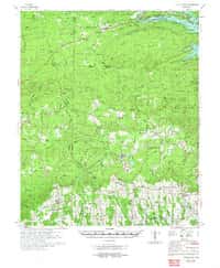
Center Point, AR
Old map for history, not navigation
USGS historical 15-minute topo (1972)

Chidester, AR
Old map for history, not navigation
USGS historical 15-minute topo (1978)

Clarendon, AR
Old map for history, not navigation
USGS historical 15-minute topo (1935)

Clarendon, AR
Old map for history, not navigation
USGS historical 15-minute topo (1941)

Clarendon, AR
Old map for history, not navigation
USGS historical 15-minute topo (1957)

Clarendon, AR
Old map for history, not navigation
USGS historical 15-minute topo (1972)

Collins, AR
Old map for history, not navigation
USGS historical 15-minute topo (1960)

Cominto, AR
Old map for history, not navigation
USGS historical 15-minute topo (1935)

Conway, AR
Old map for history, not navigation
USGS historical 15-minute topo (1961)

Cove, AR
Old map for history, not navigation
USGS historical 15-minute topo (1959)

Cravens, AR
Old map for history, not navigation
USGS historical 15-minute topo (1879)

Dardanelle #1, AR
Old map for history, not navigation
USGS historical 15-minute topo (1888)

Dardanelle #2, AR
Old map for history, not navigation
USGS historical 15-minute topo (1888)

Dardanelle #3, AR
Old map for history, not navigation
USGS historical 15-minute topo (1888)

Dardanelle #4, AR
Old map for history, not navigation
USGS historical 15-minute topo (1888)

De Valls Bluff, AR
Old map for history, not navigation
USGS historical 15-minute topo (1941)

De Valls Bluff, AR
Old map for history, not navigation
USGS historical 15-minute topo (1957)

De Valls Bluff, AR
Old map for history, not navigation
USGS historical 15-minute topo (1971)

De Witt, AR
Old map for history, not navigation
USGS historical 15-minute topo (1941)

De Witt, AR
Old map for history, not navigation
USGS historical 15-minute topo (1954)

De Witt, AR
Old map for history, not navigation
USGS historical 15-minute topo (1970)
Every Arkansas historical topo map by name
- Alexander, AR (1935)
- Alexander, AR (1941)
- Alicia, AR (1935)
- Altheimer, AR (1935)
- Antoine, AR (1943)
- Athens, AR (1936)
- Athens, AR (1942)
- Augusta, AR (1935)
- Augusta, AR (1957)
- Augusta, AR (1971)
- Bald Knob, AR (1935)
- Barber, AR (1906)
- Barber, AR (1947)
- Bates, AR (1958)
- Batson, AR (1906)
- Bearden, AR (1978)
- Bee Branch, AR (1961)
- Benton, AR (1938)
- Benton, AR (1944)
- Big Island, AR (1939)
- Blytheville, AR (1939)
- Blytheville, AR (1955)
- Blytheville, AR (1976)
- Booneville, AR (1934)
- Booneville, AR (1939)
- Brinkley, AR (1940)
- Brinkley, AR (1958)
- Center Point, AR (1972)
- Chidester, AR (1978)
- Clarendon, AR (1935)
- Clarendon, AR (1941)
- Clarendon, AR (1957)
- Clarendon, AR (1972)
- Collins, AR (1960)
- Cominto, AR (1935)
- Conway, AR (1961)
- Cove, AR (1959)
- Cravens, AR (1879)
- Dardanelle #1, AR (1888)
- Dardanelle #2, AR (1888)
- Dardanelle #3, AR (1888)
- Dardanelle #4, AR (1888)
- De Valls Bluff, AR (1941)
- De Valls Bluff, AR (1957)
- De Valls Bluff, AR (1971)
- De Witt, AR (1941)
- De Witt, AR (1954)
- De Witt, AR (1970)
- Deckerville, AR (1940)
- Deckerville, AR (1957)
- Deckerville, AR (1977)
- Dee, AR (1940)
- Dee, AR (1958)
- Dumas, AR (1971)
- Edmondson, AR (1939)
- Edmondson, AR (1954)
- El Dorado, AR (1927)
- El Dorado, AR (1930)
- El Dorado, AR (1951)
- England, AR (1937)
- England, AR (1943)
- Eudora, AR (1936)
- Eudora, AR (1957)
- Evadale, AR (1939)
- Evadale, AR (1956)
- Farrell, AR (1939)
- Farrell, AR (1955)
- Farrell, AR (1967)
- Feenyville, AR (1935)
- Felsenthal, AR (1934)
- Felsenthal, AR (1937)
- Felsenthal, AR (1938)
- Felsenthal, AR (1939)
- Fort Smith, AR (1879)
- Gainesville, AR (1940)
- Gainesville, AR (1958)
- Gainesville, AR (1960)
- Gillett, AR (1935)
- Glenwood, AR (1942)
- Glenwood, AR (1949)
- Goldman, AR (1941)
- Gravelly, AR (1960)
- Greenwood, AR (1887)
- Greenwood, AR (1947)
- Gregory, AR (1935)
- Gregory, AR (1957)
- Gregory, AR (1972)
- Gurdon, AR (1972)
- Hales Point, AR (1939)
- Hales Point, AR (1952)
- Hamburg, AR (1978)
- Hazen, AR (1935)
- Hazen, AR (1941)
- Hazen, AR (1967)
- Henrico, AR (1939)
- Henrico, AR (1954)
- Henrico, AR (1970)
- Holly Grove, AR (1940)
- Holly Grove, AR (1957)
- Holly Grove, AR (1974)
- Horseshoe Lake, AR (1931)
- Horseshoe Lake, AR (1939)
- Horseshoe Lake, AR (1954)
- Horseshoe Lake, AR (1960)
- Humphrey, AR (1969)
- Hunter, AR (1939)
- Hunter, AR (1956)
- Hunter, AR (1958)
- Indian Bay, AR (1939)
- Indian Bay, AR (1954)
- Indian Bay, AR (1970)
- Ingalls, AR (1937)
- Ingalls, AR (1939)
- Jericho, AR (1931)
- Jericho, AR (1939)
- Jericho, AR (1952)
- Jericho, AR (1961)
- Jericho, AR (1962)
- Jericho, AR (1975)
- Jonesboro, AR (1939)
- Jonesboro, AR (1958)
- Kensett, AR (1932)
- Kensett, AR (1935)
- Kensett, AR (1967)
- Knobel, AR (1935)
- Knobel, AR (1941)
- Knobel, AR (1967)
- Lake Village, AR (1936)
- Lake Village, AR (1955)
- Lamont, AR (1933)
- Latour, AR (1939)
- Latour, AR (1955)
- Latour, AR (1961)
- Latour, AR (1963)
- Lavaca, AR (1906)
- Lavaca, AR (1947)
- Leachville, AR (1941)
- Leachville, AR (1956)
- Lonoke, AR (1940)
- Lonoke, AR (1949)
- Lonoke, AR (1950)
- Louann, AR (1964)
- Magazine Mountain #1, AR (1887)
- Magazine Mountain #2, AR (1887)
- Magazine Mountain #3, AR (1887)
- Magazine Mountain #4, AR (1887)
- Malvern, AR (1948)
- Malvern, AR (1949)
- Manila, AR (1941)
- Manila, AR (1956)
- Marianna, AR (1940)
- Marianna, AR (1957)
- Marked Tree, AR (1941)
- Marked Tree, AR (1956)
- Marmaduke, AR (1940)
- Marmaduke, AR (1958)
- Marmaduke, AR (1959)
- Marshall #3, AR (1889)
- Marvell, AR (1940)
- Marvell, AR (1956)
- McGehee, AR (1936)
- McGehee, AR (1937)
- McGehee, AR (1955)
- Melbourne, AR (1951)
- Mellwood, AR (1930)
- Mellwood, AR (1939)
- Mellwood, AR (1954)
- Mellwood, AR (1962)
- Mena, AR (1958)
- Mist, AR (1935)
- Mist, AR (1960)
- Modoc, AR (1939)
- Modoc, AR (1948)
- Modoc, AR (1963)
- Modoc, AR (1964)
- Moro Bay, AR (1934)
- Moro Bay, AR (1938)
- Moro Bay, AR (1939)
- Morrilton No 3, AR (1889)
- Mount Ida #2, AR (1887)
- Mount Ida, AR (1959)
- Mountain Home, AR (1879)
- Mt Judea, AR (1933)
- Mt Judea, AR (1940)
- Murfreesboro, AR (1972)
- Newport, AR (1935)
- Newport, AR (1962)
- Newport, AR (1966)
- Noble Lake, AR (1935)
- Noble Lake, AR (1978)
- Oden, AR (1959)
- Osceola, AR (1965)
- Osceola, AR (1977)
- Ozone, AR (1889)
- Ozone, AR (1934)
- Ozone, AR (1936)
- Park Place, AR (1939)
- Park Place, AR (1955)
- Park Place, AR (1962)
- Park Place, AR (1963)
- Parks, AR (1960)
- Pastoria, AR (1932)
- Pastoria, AR (1935)
- Piggott, AR (1940)
- Piggott, AR (1956)
- Poteau Mountain #1, AR (1887)
- Poteau Mountain #2, AR (1887)
- Poteau Mountain, AR (1879)
- Potter, AR (1958)
- Powhatan, AR (1934)
- Powhatan, AR (1935)
- Princedale, AR (1940)
- Princedale, AR (1956)
- Princedale, AR (1962)
- Princedale, AR (1966)
- Princeton, AR (1978)
- Readland, AR (1939)
- Readland, AR (1972)
- Rector, AR (1935)
- Rector, AR (1958)
- Rector, AR (1960)
- Red Fork, AR (1935)
- Refuge, AR (1939)
- Reyno, AR (1935)
- Rotan, AR (1935)
- Rotan, AR (1968)
- Salem, AR (1950)
- Salem, AR (1951)
- Sedgwick, AR (1935)
- Sedgwick, AR (1959)
- Sedgwick, AR (1960)
- Smackover, AR (1964)
- Smyrna, AR (1887)
- Smyrna, AR (1940)
- Smyrna, AR (1943)
- Snowball, AR (1939)
- Snowball, AR (1941)
- Snowball, AR (1942)
- Snowball, AR (1949)
- St Paul, AR (1943)
- St Paul, AR (1946)
- Star City, AR (1978)
- Strawberry, AR (1932)
- Strawberry, AR (1935)
- Strawberry, AR (1941)
- Strong, AR (1933)
- Strong, AR (1937)
- Strong, AR (1939)
- Stuttgart, AR (1937)
- Stuttgart, AR (1939)
- Stuttgart, AR (1971)
- Texarkana, AR (1909)
- Tilton, AR (1940)
- Tilton, AR (1956)
- Treat, AR (1889)
- Treat, AR (1932)
- Treat, AR (1934)
- Tuckerman, AR (1935)
- Tuckerman, AR (1967)
- Umpire, AR (1959)
- Van Buren, AR (1887)
- Van Buren, AR (1947)
- Vanndale, AR (1939)
- Vanndale, AR (1958)
- Varner, AR (1935)
- Varner, AR (1978)
- Waldron, AR (1939)
- Waldron, AR (1940)
- Waldron, AR (1941)
- Waldron, AR (1949)
- Walnut Ridge, AR (1932)
- Walnut Ridge, AR (1935)
- Walnut Ridge, AR (1968)
- Warren, AR (1978)
- Washington, AR (1879)
- Watalula, AR (1887)
- Watalula, AR (1939)
- Weiner, AR (1939)
- Weiner, AR (1959)
- Weiner, AR (1960)
- Whitmore, AR (1940)
- Whitmore, AR (1956)
- Whitmore, AR (1960)
- Whitmore, AR (1965)
- Wilmot, AR (1935)
- Wilmot, AR (1960)
- Winslow #3, AR (1898)
- Winslow #4, AR (1898)
- Wynne, AR (1939)
- Wynne, AR (1958)