Alabama historical topo maps
Cartahaven has 120 historical topo maps of Alabama, all free. These are the USGS 15-minute (1:62,500) quadrangles from the mid-1900s: old roads, mines, homesteads, rail lines and place names that newer maps leave off.
Download one to your phone and the map app shows your GPS position on it with no cell signal.

Anniston, AL
Old map for history, not navigation
USGS historical 15-minute topo (1950)

Autaugaville, AL
Old map for history, not navigation
USGS historical 15-minute topo (1957)

Barton, AL
Old map for history, not navigation
USGS historical 15-minute topo (1925)

Barton, AL
Old map for history, not navigation
USGS historical 15-minute topo (1929)

Bay Minette, AL
Old map for history, not navigation
USGS historical 15-minute topo (1941)

Bay Minette, AL
Old map for history, not navigation
USGS historical 15-minute topo (1943)

Benton, AL
Old map for history, not navigation
USGS historical 15-minute topo (1957)

Bessemer Iron District, AL
Old map for history, not navigation
USGS historical 15-minute topo (1905)

Bessemer Iron District, AL
Old map for history, not navigation
USGS historical 15-minute topo (1907)

Billingsley, AL
Old map for history, not navigation
USGS historical 15-minute topo (1959)

Birmingham Coal District, AL
Old map for history, not navigation
USGS historical 15-minute topo (1904)

Birmingham Special, AL
Old map for history, not navigation
USGS historical 15-minute topo (1906)

Blocton, AL
Old map for history, not navigation
USGS historical 15-minute topo (1934)

Blocton, AL
Old map for history, not navigation
USGS historical 15-minute topo (1940)

Bon Secour, AL
Old map for history, not navigation
USGS historical 15-minute topo (1921)

Braggs, AL
Old map for history, not navigation
USGS historical 15-minute topo (1957)

Brundidge, AL
Old map for history, not navigation
USGS historical 15-minute topo (1948)

Brundidge, AL
Old map for history, not navigation
USGS historical 15-minute topo (1950)

Carlowville, AL
Old map for history, not navigation
USGS historical 15-minute topo (1957)

Cedar Point, AL
Old map for history, not navigation
USGS historical 15-minute topo (1941)

Cedar Point, AL
Old map for history, not navigation
USGS historical 15-minute topo (1943)

Choctaw Bluff, AL
Old map for history, not navigation
USGS historical 15-minute topo (1943)

Choctaw Bluff, AL
Old map for history, not navigation
USGS historical 15-minute topo (1946)

Citronelle, AL
Old map for history, not navigation
USGS historical 15-minute topo (1943)

Citronelle, AL
Old map for history, not navigation
USGS historical 15-minute topo (1946)

Columbiana, AL
Old map for history, not navigation
USGS historical 15-minute topo (1909)

Columbiana, AL
Old map for history, not navigation
USGS historical 15-minute topo (1911)

Cottondale, AL
Old map for history, not navigation
USGS historical 15-minute topo (1934)

Creola, AL
Old map for history, not navigation
USGS historical 15-minute topo (1941)

Creola, AL
Old map for history, not navigation
USGS historical 15-minute topo (1943)
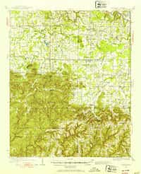
Danville, AL
Old map for history, not navigation
USGS historical 15-minute topo (1935)

Danville, AL
Old map for history, not navigation
USGS historical 15-minute topo (1938)

Dauphin Island, AL
Old map for history, not navigation
USGS historical 15-minute topo (1921)

Deer Park, AL
Old map for history, not navigation
USGS historical 15-minute topo (1942)

Deer Park, AL
Old map for history, not navigation
USGS historical 15-minute topo (1943)

Delchamps, AL
Old map for history, not navigation
USGS historical 15-minute topo (1921)

Dyas, AL
Old map for history, not navigation
USGS historical 15-minute topo (1942)

Dyas, AL
Old map for history, not navigation
USGS historical 15-minute topo (1944)

Elmore, AL
Old map for history, not navigation
USGS historical 15-minute topo (1959)

Enterprise, AL
Old map for history, not navigation
USGS historical 15-minute topo (1950)

Epes, AL
Old map for history, not navigation
USGS historical 15-minute topo (1932)

Eutaw, AL
Old map for history, not navigation
USGS historical 15-minute topo (1931)

Fairhope, AL
Old map for history, not navigation
USGS historical 15-minute topo (1921)
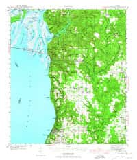
Fairhope, AL
Old map for history, not navigation
USGS historical 15-minute topo (1941)

Fairhope, AL
Old map for history, not navigation
USGS historical 15-minute topo (1943)
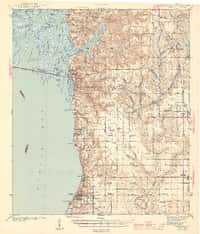
Fairhope, AL
Old map for history, not navigation
USGS historical 15-minute topo (1944)

Foley, AL
Old map for history, not navigation
USGS historical 15-minute topo (1941)

Foley, AL
Old map for history, not navigation
USGS historical 15-minute topo (1943)
Every Alabama historical topo map by name
- Anniston, AL (1950)
- Autaugaville, AL (1957)
- Barton, AL (1925)
- Barton, AL (1929)
- Bay Minette, AL (1941)
- Bay Minette, AL (1943)
- Benton, AL (1957)
- Bessemer Iron District, AL (1905)
- Bessemer Iron District, AL (1907)
- Billingsley, AL (1959)
- Birmingham Coal District, AL (1904)
- Birmingham Special, AL (1906)
- Blocton, AL (1934)
- Blocton, AL (1940)
- Bon Secour, AL (1921)
- Braggs, AL (1957)
- Brundidge, AL (1948)
- Brundidge, AL (1950)
- Carlowville, AL (1957)
- Cedar Point, AL (1941)
- Cedar Point, AL (1943)
- Choctaw Bluff, AL (1943)
- Choctaw Bluff, AL (1946)
- Citronelle, AL (1943)
- Citronelle, AL (1946)
- Columbiana, AL (1909)
- Columbiana, AL (1911)
- Cottondale, AL (1934)
- Creola, AL (1941)
- Creola, AL (1943)
- Danville, AL (1935)
- Danville, AL (1938)
- Dauphin Island, AL (1921)
- Deer Park, AL (1942)
- Deer Park, AL (1943)
- Delchamps, AL (1921)
- Dyas, AL (1942)
- Dyas, AL (1944)
- Elmore, AL (1959)
- Enterprise, AL (1950)
- Epes, AL (1932)
- Eutaw, AL (1931)
- Fairhope, AL (1921)
- Fairhope, AL (1941)
- Fairhope, AL (1943)
- Fairhope, AL (1944)
- Foley, AL (1941)
- Foley, AL (1943)
- Fort Barrancas, AL (1921)
- Fort Morgan, AL (1942)
- Gantts Quarry, AL (1915)
- Gantts Quarry, AL (1917)
- Geneva, AL (1957)
- Goodwater, AL (1944)
- Goodwater, AL (1947)
- Grand Bay, AL (1921)
- Grand Bay, AL (1943)
- Grand Bay, AL (1958)
- Gravelly Springs, AL (1924)
- Gravelly Springs, AL (1926)
- Hartford, AL (1957)
- Hurley, AL (1941)
- Hurley, AL (1943)
- Jacksonville, AL (1947)
- Leeds, AL (1905)
- Leeds, AL (1907)
- Letohatchee, AL (1957)
- McIntosh, AL (1943)
- McIntosh, AL (1944)
- Mobile, AL (1922)
- Mobile, AL (1940)
- Mobile, AL (1944)
- Montevallo, AL (1910)
- Montgomery, AL (1930)
- Montgomery, AL (1958)
- Mount Meigs, AL (1958)
- Mt Hope, AL (1936)
- Mt Hope, AL (1940)
- Muscle Shoals, AL (1916)
- Muscogee, AL (1921)
- Ozark, AL (1948)
- Ozark, AL (1950)
- Perdido, AL (1942)
- Perdido, AL (1944)
- Petit Bois Island, AL (1921)
- Petit Bois Island, AL (1942)
- Plantersville, AL (1959)
- Point Clear, AL (1921)
- Port Birmingham, AL (1938)
- Ragland, AL (1947)
- Robertsdale, AL (1920)
- Robertsdale, AL (1941)
- Robertsdale, AL (1943)
- Rogersville, AL (1916)
- Samantha, AL (1928)
- Seale, AL (1914)
- Seale, AL (1950)
- Seale, AL (1955)
- Searles, AL (1934)
- Selma, AL (1958)
- Steele, AL (1947)
- Summerfield, AL (1959)
- Talladega, AL (1943)
- Talladega, AL (1946)
- Tensaw, AL (1943)
- Tensaw, AL (1944)
- Tuscaloosa, AL (1924)
- Tuscaloosa, AL (1926)
- Tuscumbia, AL (1924)
- Tuscumbia, AL (1926)
- Vandiver, AL (1906)
- Vandiver, AL (1908)
- Weeks Bay, AL (1941)
- Weeks Bay, AL (1943)
- Wetumpka, AL (1901)
- Wetumpka, AL (1959)
- Wilmer, AL (1942)
- Wilmer, AL (1944)
- Yolande, AL (1932)
- Yolande, AL (1935)