Tug Mountain, ME Historical Topo Map (1943)
by USGS Historical Topo Maps (public domain) · Maine, US
A free GeoPDF for offline GPS in the Cartahaven app, with free updates. How it works offline
Try it now, no account needed
Open this map in the Cartahaven map app in your browser and see your GPS position on it.
Older edition. This is the 1943 edition from the U.S. Geological Survey. A newer one may have been published since; check the agency's page for current rules and routes before relying on it.

About the Tug Mountain quad
The Tug Mountain quadrangle is a USGS 15-minute historical topo map covering about 12 × 17 mi of Washington County, Maine. This is the 1943 edition; the GeoPDF is 7.3 MB.
What you get
- Your GPS position on the map. A blue dot on this official sheet shows where you are.
- Works with no signal. Download it once; the map and your GPS position keep working with no cell signal.
- Tracks, placemarks and photos. Record where you go, drop pins, and export GPX, KML or GeoJSON.
- Free updates. When a new edition is published here, it’s yours at no cost.
- 1Tap “Get this map”: it’s added to your free account.
- 2Open the Cartahaven app on your phone and sign in.
- 3Tap “Get my maps”. It’s on your phone, ready offline.
The app runs on iPhone, Android and in desktop browsers. Install it · How offline GPS works
Where this map covers
Named places on this map
74 named features inside the Tug Mountain, ME — USGS historical 15-minute topo (1943) sheet, from the USGS Geographic Names Information System. Each one links to every map that shows it.
Peaks and ridges
- Bacon Ridge · ridge
- Bald Head
- Beech Hill
- Ben Tucker Mountain
- Breakneck Hill
- Canaan Ridge · ridge
- Cranberry Lake Ridge · ridge
- Cranberry Mountain
- Elwell Ridge · ridge
- Hall Ridge · ridge
- Indian Ridge · ridge
- Knox Hill
- Lower Buck Mountain
- Northeast Hill
- Peaked Mountain
- Porcupine Pinnacle
- Spruce Ridge · ridge
- Tibbets Ridge · ridge
- Tug Mountain
- Upper Buck Mountain
Lakes, springs and falls
- Allen Heath · swamp
- Barren Pond · lake
- Beech Hill Heath · swamp
- Big Heath · swamp
- Black Brook Ponds · lake
- Bog Brook Flowage · reservoir
- Bowles Lake · lake
- Brandy Heath · swamp
- Bridgham Swamp · swamp
- Dead Pond · lake
- Dick Allen Cove · bay
- Duck Pond · lake
- First Lake · lake
- First Lake · reservoir
- Flynn Pond · lake
- Goose Pond · lake
- Grass Pond · lake
- Grassy Pond · lake
- Hadley Lakes · lake
- Horse Rips · rapids
- Ingley Cove · bay
- Kerosene Pond · lake
- Lily Lake · lake
- Little Falls · falls
and 24 more
Gaps, arches and other landforms
- Crebo Flat · flat
- Dorman Island · island
- Elsie Point · cape
- Northeast Bluff · cliff
- Southwest Bluff · cliff
- The Middle Grounds · flat
Elevations are the USGS 3DEP ground elevation at the named point, rounded; a summit's surveyed height can differ a little.
More maps of Maine.
Maps nearby
More maps around here ›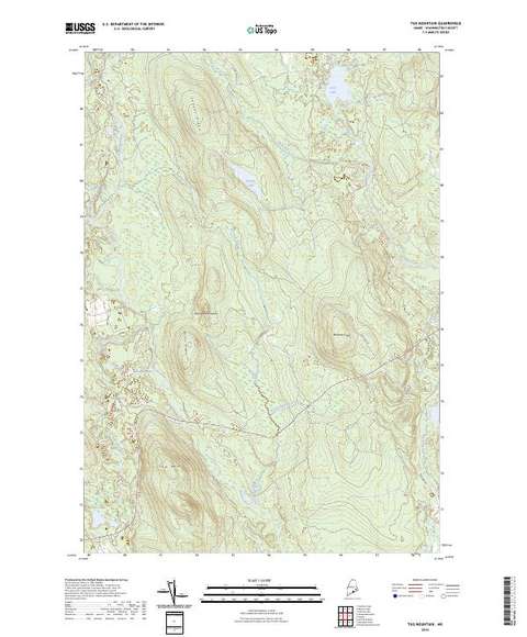
Tug Mountain, ME
Detailed map of terrain, trails and roads
USGS topo, 2024

Tug Mountain, ME
Old map for history, not navigation
USGS historical 15-minute topo (1941)

Bureau of Land Management Eastern States Overview map
BLM Eastern States (2019)

Peaked Mountain, ME
Detailed map of terrain, trails and roads
USGS topo, 2024

Montegail Pond, ME
Detailed map of terrain, trails and roads
USGS topo, 2024

Northeast Bluff, ME
Detailed map of terrain, trails and roads
USGS topo, 2024
Version history
Version 1 · Nov 6, 2026 · 7.3 MB