Thayer, MI Forest Service Topo Map (FSTopo)
by Forest Service FSTopo Quads (public domain), US
A free GeoPDF for offline GPS in the Cartahaven app, with free updates. How it works offline

About the Thayer quad
The Thayer quadrangle is a Forest Service FSTopo 7.5-minute map at 1:24,000 covering about 7.7 × 9.9 mi of Gogebic County, Michigan. It overlaps Ottawa National Forest. The GeoPDF is 1.5 MB.
All Michigan Forest Service FSTopo maps · Michigan hunting units
What you get
- Your GPS position on the map. A blue dot on this official sheet shows where you are.
- Works with no signal. Download it once; the map and your GPS position keep working with no cell signal.
- Tracks, placemarks and photos. Record where you go, drop pins, and export GPX, KML or GeoJSON.
- Free updates. When a new edition is published here, it’s yours at no cost.
- 1Tap “Get this map”: it’s added to your free account.
- 2Open the Cartahaven app on your phone and sign in.
- 3Tap “Get my maps”. It’s on your phone, ready offline.
The app runs on iPhone, Android and in desktop browsers. Install it · How offline GPS works
Where this map covers
Named places on this map
36 named features inside the Thayer — Forest Service FSTopo 7.5-minute quad sheet, from the USGS Geographic Names Information System. Each one links to every map that shows it.
Lakes, springs and falls
- Bay Lake · lake
- Beatons Lake · lake
- Bergner Lake · lake
- Big African Lake · lake
- Big Mosquito Lake · lake
- Clearwater Lake · lake
- Cloverleaf Lake · lake
- Cornelia Lake · lake
- Cox Lake · lake
- Cup Lake · lake
- Damon Lake · lake
- Deeryard Lake · lake
- Foggy Lake · lake
- Grace Lake · lake
- Hartley Lake · lake
- Hattie Lake · lake
- Hemlock Lake · lake
- Hummingbird Lake · lake
- Kakabika Falls · falls
- Langford Lake · lake
- Little African Lake · lake
- Little Beatons Lake · lake
- Little Langford Lake · lake
- Little Mosquito Lake · lake
and 12 more
Elevations are the USGS 3DEP ground elevation at the named point, rounded; a summit's surveyed height can differ a little.
More maps of Ottawa National Forest.
Maps nearby
More maps around here ›
Thayer, MI
Detailed map of terrain, trails and roads
USGS topo, 2023
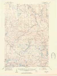
Thayer, MI
Old map for history, not navigation
USGS historical 15-minute topo (1952)

Ottawa National Forest
Forest Service forest map

Bureau of Land Management Eastern States Overview map
BLM Eastern States (2019)

Gogebic
Forest Service topo with road numbers
Forest Service FSTopo 7.5-minute quad

Beaton
Forest Service topo with road numbers
Forest Service FSTopo 7.5-minute quad
Version history
Version 1 · Nov 8, 2026 · 1.5 MB