New Mexico Game Management Unit 59 (GMU 59: Beginning at the intersection of NM 39 and US 56 at Abbott, then east al)
Game Management Units (all big game) · New Mexico Department of Game and Fish
Unit boundary
Simplified for the web from the public layer of New Mexico Department of Game and Fish (source and terms). Units change with each season's regulations, and the legal boundary description in the regulations is what counts.
Legal shooting light this week
New Mexico's general big-game hours: 30 minutes before sunrise to 30 minutes after sunset, worked out for the middle of the unit (36.150, -103.631) on local time. Times can be a minute or two off at the unit's edges.
| Day | Shooting light starts (MST) | Ends | Sunrise | Sunset |
|---|---|---|---|---|
| 5:48 AM | 5:26 PM | 6:17 AM | 4:56 PM | |
| 5:49 AM | 5:25 PM | 6:18 AM | 4:55 PM | |
| 5:50 AM | 5:24 PM | 6:19 AM | 4:54 PM | |
| 5:51 AM | 5:23 PM | 6:20 AM | 4:53 PM | |
| 5:52 AM | 5:22 PM | 6:21 AM | 4:52 PM | |
| 5:53 AM | 5:22 PM | 6:22 AM | 4:52 PM | |
| 5:54 AM | 5:21 PM | 6:23 AM | 4:51 PM |
Turkey, waterfowl, some public lands and opening days have their own hours. Always check the New Mexico regulations for your species (where this rule comes from).
Maps that cover this unit
See all maps in this area ›
Beenham, NM — USGS 7.5-minute topo (2023)
USGS Topo Maps (public domain) · New Mexico
Public domain

Garcia Creek, NM — USGS 7.5-minute topo (2023)
USGS Topo Maps (public domain) · New Mexico
Public domain

Beenham SW, NM — USGS 7.5-minute topo (2023)
USGS Topo Maps (public domain) · New Mexico
Public domain

Minnie Butte, NM — USGS 7.5-minute topo (2023)
USGS Topo Maps (public domain) · New Mexico
Public domain

Aragon Hill, NM — USGS 7.5-minute topo (2023)
USGS Topo Maps (public domain) · New Mexico
Public domain

Yates SE, NM — USGS 7.5-minute topo (2023)
USGS Topo Maps (public domain) · New Mexico
Public domain

Pennington, NM — USGS 7.5-minute topo (2023)
USGS Topo Maps (public domain) · New Mexico
Public domain

Goat Canyon, NM — USGS 7.5-minute topo (2023)
USGS Topo Maps (public domain) · New Mexico
Public domain

Car Top Butte, NM — USGS 7.5-minute topo (2023)
USGS Topo Maps (public domain) · New Mexico
Public domain

Pedernal Creek, NM — USGS 7.5-minute topo (2023)
USGS Topo Maps (public domain) · New Mexico
Public domain

Romero Spring, NM — USGS 7.5-minute topo (2023)
USGS Topo Maps (public domain) · New Mexico
Public domain

Tate School, NM — USGS 7.5-minute topo (2023)
USGS Topo Maps (public domain) · New Mexico
Public domain

Bueyeros, NM — USGS 7.5-minute topo (2023)
USGS Topo Maps (public domain) · New Mexico
Public domain

Bueyeros NE, NM — USGS 7.5-minute topo (2023)
USGS Topo Maps (public domain) · New Mexico
Public domain

Albert, NM — USGS 7.5-minute topo (2023)
USGS Topo Maps (public domain) · New Mexico
Public domain

Cottonwood Springs, NM — USGS 7.5-minute topo (2023)
USGS Topo Maps (public domain) · New Mexico
Public domain

Yates, NM — USGS 7.5-minute topo (2023)
USGS Topo Maps (public domain) · New Mexico
Public domain

Valencia Spring, NM — USGS 7.5-minute topo (2023)
USGS Topo Maps (public domain) · New Mexico
Public domain

Clapham, NM — USGS 7.5-minute topo (2023)
USGS Topo Maps (public domain) · New Mexico
Public domain

Skull Mesa, NM — USGS 7.5-minute topo (2023)
USGS Topo Maps (public domain) · New Mexico
Public domain
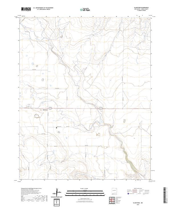
Gladstone, NM — USGS 7.5-minute topo (2023)
USGS Topo Maps (public domain) · New Mexico
Public domain

Tripod Mountain, NM — USGS 7.5-minute topo (2023)
USGS Topo Maps (public domain) · New Mexico
Public domain

Snyder Lake, NM — USGS 7.5-minute topo (2023)
USGS Topo Maps (public domain) · New Mexico
Public domain

Sand Hill, NM — USGS 7.5-minute topo (2023)
USGS Topo Maps (public domain) · New Mexico
Public domain