Smith Spring
Spring in Greenlee County, Arizona · on the USGS Copperplate Gulch quadrangle
33.05586, -109.47235
Maps that show Smith Spring
Get them in the map app
Copperplate Gulch, AZ
Detailed map of terrain, trails and roads
USGS topo, 2026

Copperplate Gulch
Forest Service topo with road numbers
Forest Service FSTopo 7.5-minute quad

Clifton, AZ
Old map for history, not navigation
USGS historical 15-minute topo (1902)
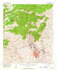
Clifton, AZ
Old map for history, not navigation
USGS historical 15-minute topo (1962)

Clifton 30x60 Land Ownership (BLM Surface Management)
Land Ownership Maps from BLM Data · Arizona

Apache-Sitgreaves National Forests
Forest Service forest map

BLM Arizona Wilderness and Wilderness Study Areas Map
BLM Arizona (2022)

BLM Arizona Office Locations Map
BLM Arizona (2022)

BLM Arizona National Conservation Lands Map
BLM Arizona (2022)

BLM Arizona Administrative Boundaries Map
BLM Arizona (2022)

BLM Arizona Surface Management
BLM Arizona (2022)

IFR Enroute Low Altitude Chart L-05 (U.S.)
FAA, 2026-10-29

IFR Enroute High Altitude Chart H-04 (U.S.)
FAA, 2026-10-29
Name, class, county and location: USGS Geographic Names Information System (public domain).